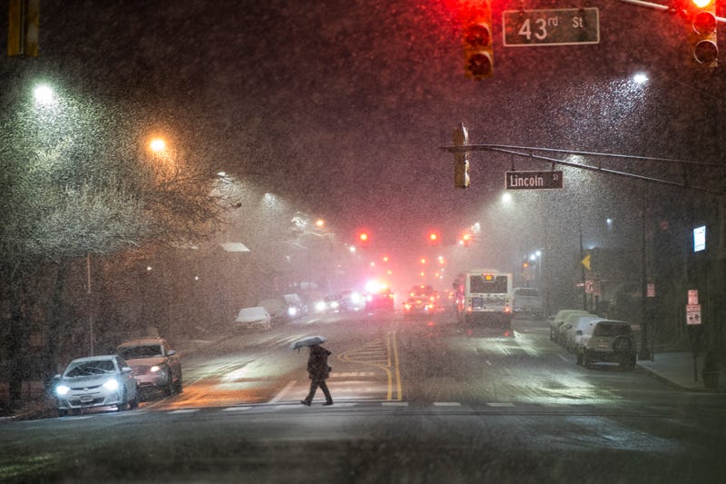

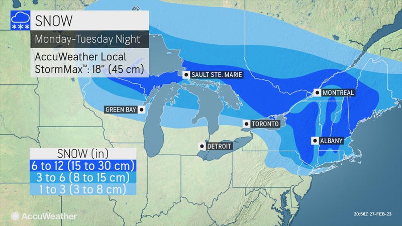
NEW YORK (1010 WINS/WCBS 880) – It took until the end of February, but the New York City area finally got its first significant snowfall of the season late Monday into Tuesday—and another round of winter weather is in the forecast to end the week.
New Yorkers were wading through a snowy, slushy mess of 1 to 3 inches of snow in the five boroughs Tuesday morning. Around 3 to 6 inches fell in areas north of the city, according to AccuWeather.
The snowfall wasn’t especially heavy for an area that can easily see a half-foot in February, but it was notable in what has been an unusually snowless winter.
Winter weather advisories and warnings for the area that had been in effect overnight ended early around 9 a.m. as the snowstorm moved out.
Central Park recorded 1.8 inches on Tuesday. Only 2.2 inches of snow have been recorded in the park this winter in what has been an especially snowless season. New York City didn’t see its first measurable snowfall (at least 0.1 inches) in Central Park until Feb. 1. It was the latest measurable snow on record, surpassing the previous record set on Jan. 29, 1973.
Areas of the Bronx saw more than 5 inches, while areas of Queens saw 2.5 inches, according to the National Weather Service. Parts of the Hudson Valley, North Jersey and Connecticut had the most snow in the New York area, with 8.5 inches measured in Orange County, 6 inches in Passaic County and 7 inches in Fairfield County.
Commuters endured a slow morning as snow mixed with a slippery sleet and rain, but there were no major impacts to mass transit. Alternate side parking remains suspended Tuesday for snow removal.
Temps hovered just above freezing in the city, which saw less snow accumulation than parts of North Jersey, the Hudson Valley and Connecticut.
Much of the accumulation is expected to melt as highs reach near 40 in the afternoon. But the slush may refreeze into slick spots Tuesday night as lows drop to around 30 degrees.
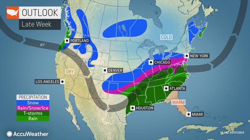
Wednesday will be partly sunny and breezy with a high of 45 before potential showers late in the day.
A couple of morning showers are also likely Thursday before conditions turn breezy and mild in the afternoon. The high will be 56.
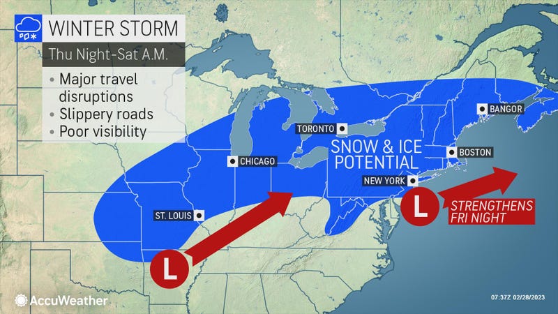
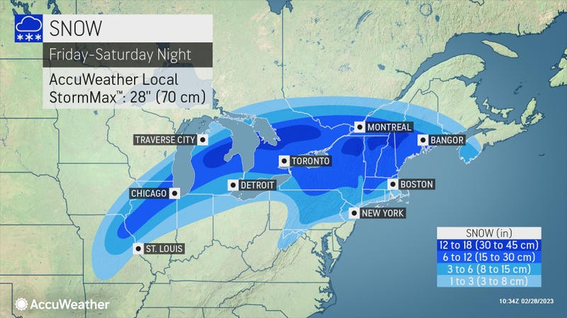
Another storm is in the forecast for Friday. It will be a wintry mix of rain and snow that will run Friday night into early Saturday morning. Highs will be around 40 both Friday and Saturday, so any accumulation likely won't stick around for long. Overall, it will probably be a wetter, less snowy system than Tuesday’s storm.
Conditions will dry out later Saturday for a partly sunny Sunday, with highs in the low to mid 40s.
Related

Related

Related
