
NEW YORK (1010 WINS) – While most of the rain is gone, the first nor’easter of the season isn’t over yet, with strong winds picking up Wednesday during the second day of the storm.

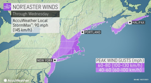
The eastern end of Long Island will get the strongest winds, but brisk gusts will be felt in the five boroughs as well.
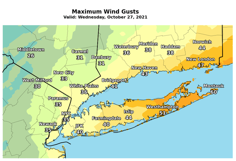
At their peak on Wednesday morning and early afternoon, northerly winds will gust up to 40 mph in the city and up to 60 mph on eastern Long Island, with some gusts in Suffolk County potentially topping 60, according to AccuWeather.
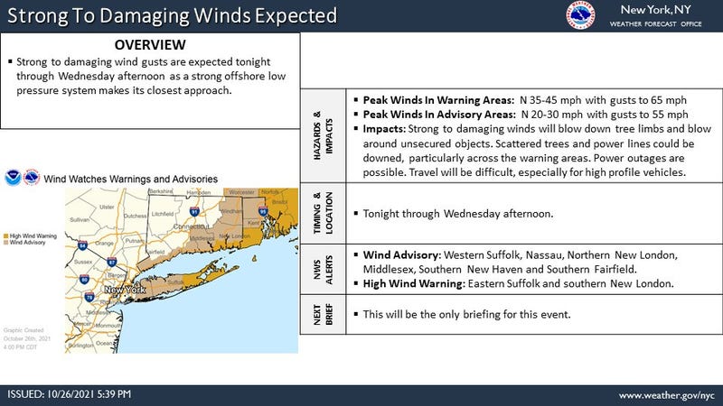
A High Wind Warning is in effect for eastern Suffolk County until 2 p.m., while parts of central Long Island are under a Wind Advisory.
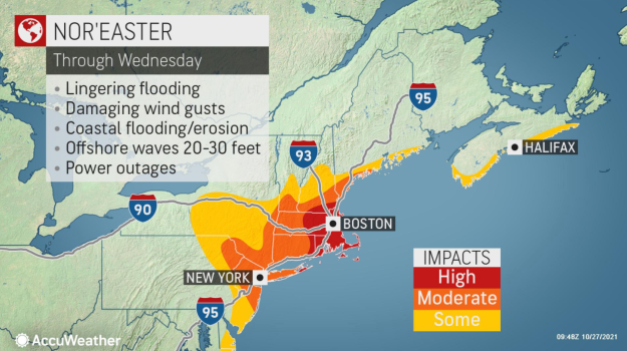
The National Weather Service warned of damaging wind gusts, saying trees and power lines could be toppled, leading to power outages and unsafe travel conditions.
There’s also a risk of coastal flooding, especially along the North Shore of Long Island, during the blustery day.
It’s breezy on Wednesday evening before lows drop to the 40s in the city and nearby suburbs overnight.
Thursday is sunny and calmer, with a high of 60.
It becomes cloudy and breezy on Friday before more rain moves in. The high will be 59.
Another round of rain is in the forecast for Saturday, when the high will be 62, but it looks dry with some sun for Halloween on Sunday. Highs will be in the 60s.
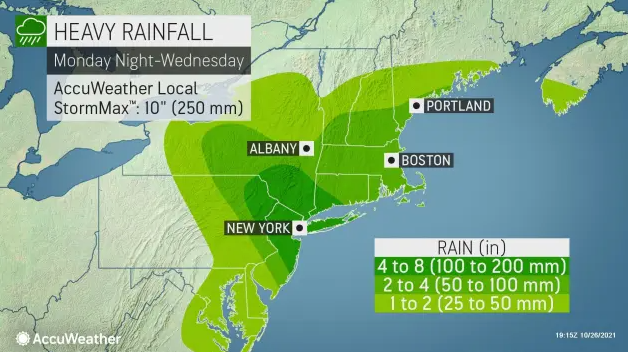
The nor’easter, which moved in late Monday, dumped inches of rain across the Tri-State on Tuesday, with parts of New Jersey and Suffolk County seeing over 5 inches. There was over 4 inches in parts of New York City and Connecticut. The Bronx saw the most rain in the five boroughs at 4.73 inches, while Midtown Manhattan had over 3 inches.
The storm knocked out power to thousands of customers across the Tri-State, a large share of them in New Jersey. Police also responded to hundreds of crashes, and there were reports of downed trees and street flooding, including in Brooklyn and Queens.
Related
