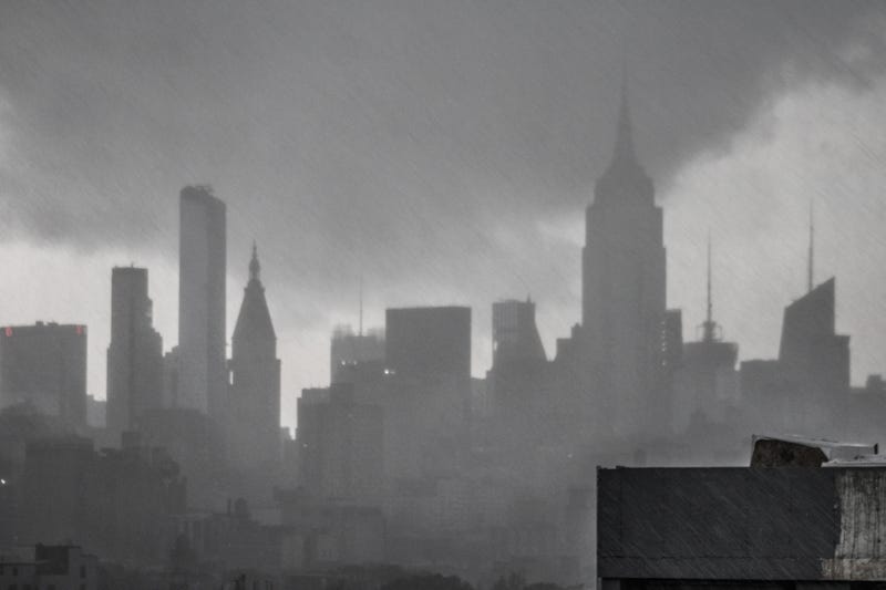

NEW YORK (1010 WINS) -- A severe thunderstorm warning has been issued for most of New York City and parts of Long Island, New Jersey and Westchester County, with damaging winds and hail possible.
The warning is in effect for Manhattan, the Bronx, Queens, Hudson County, Eastern Passaic County, Bergen County, Essex County, Southern Westchester County and Northwestern Nassau County until 3 p.m. on Wednesday, according to the National Weather Service.
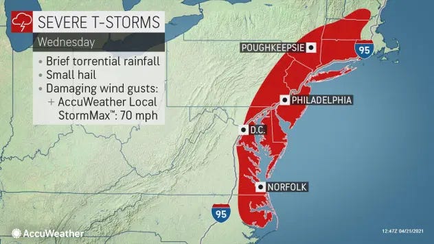
The National Weather Service issued a severe thunderstorm watch for New York City and other parts of the tristate at 12:30 p.m. It lasts until 6 p.m.
There's the potential for thunderstorms in the afternoon and evening that could produce small hail and damaging wind gusts of up to 60 mph, according to AccuWeather.
The storms are set to arrive in the city between 2 and 2:30 p.m. before moving out by 5 or 6 p.m.
Meanwhile, parts of western New York state are forecast to see inches of snow.
The high will be 64 degrees on Wednesday, but it turns blustery and much colder overnight. The low will be 36 degrees in the city and in nearby suburbs, while inland suburbs will drop below freezing.
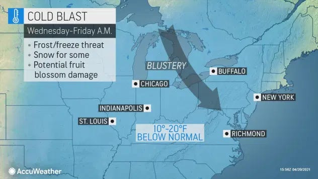
Thursday starts cold, with RealFeels in the 20s. It will be windy and chilly throughout the day with sun and clouds. The high will be 52.
It’s milder and mostly sunny on Friday with a high of 64.
Highs will be in the upper 60s on Saturday and in the low 60s on Sunday. Rain is in the forecast Saturday night, but it should taper off Sunday.