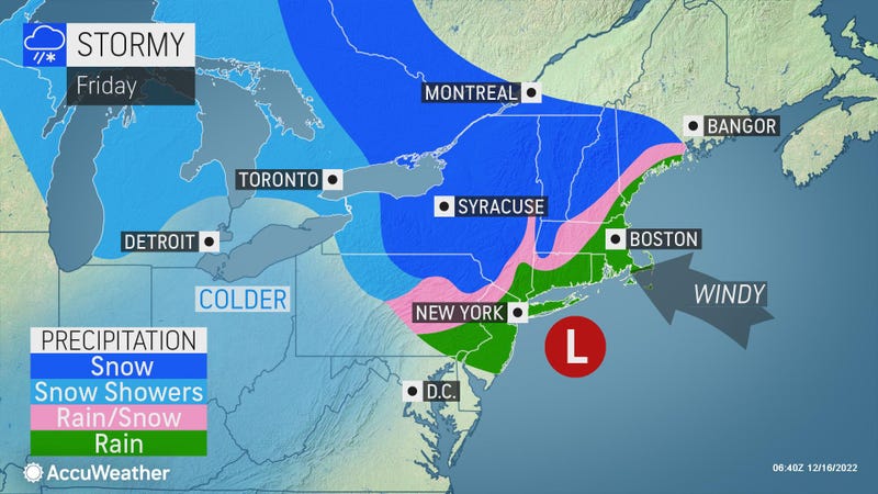

NEW YORK (1010 WINS/WCBS 880) -- A two-day storm will continue to lash the New York City area with wind, rain and wet snow Friday ahead of a colder weekend and arctic blast next week.
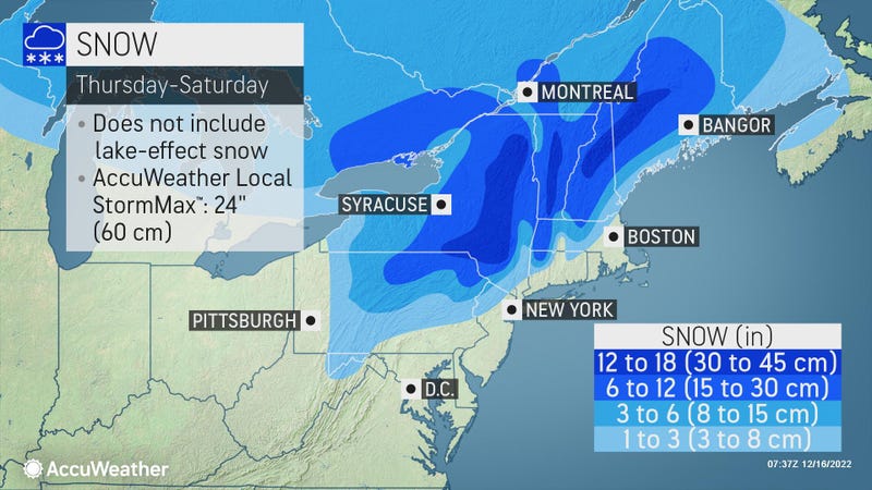
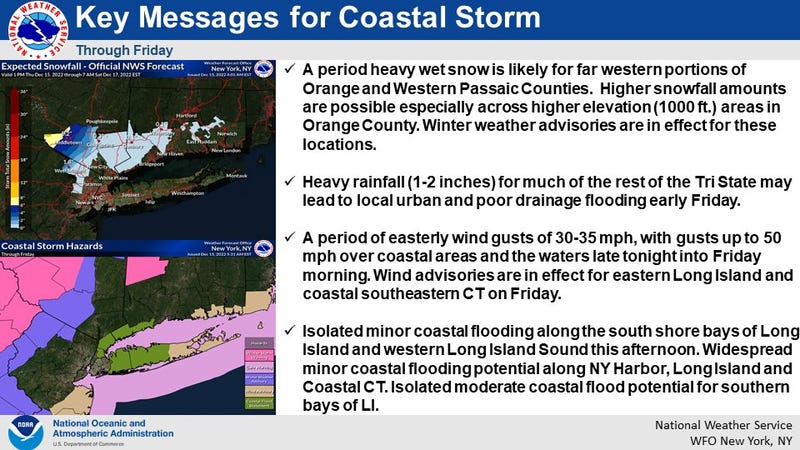
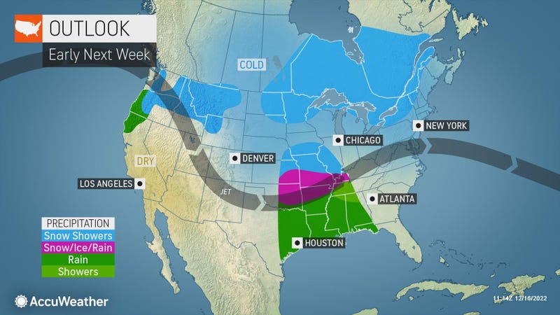
Friday was set to be a wet and windy mess for the entire area. The heaviest rain will come down in the morning before lingering throughout the day and tapering off by evening. There may be some snow showers further inland.
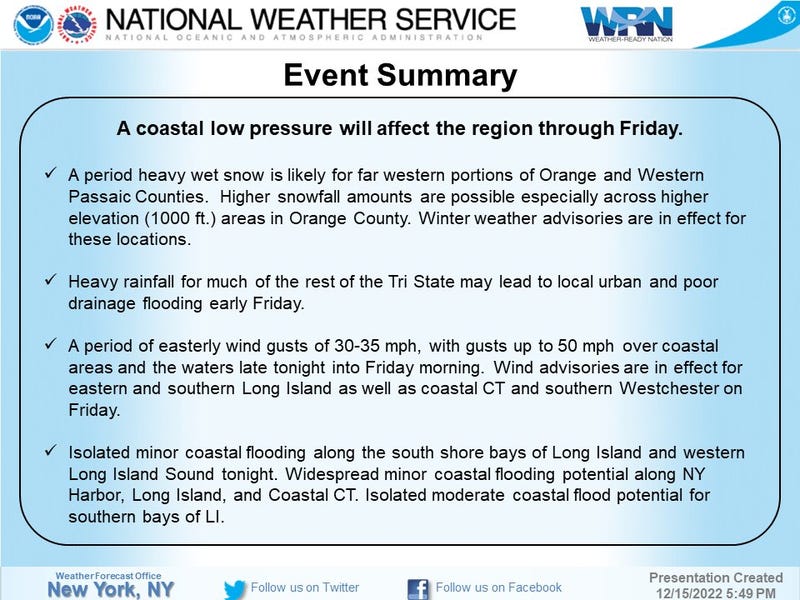
Wind gusts could top 50 mph in some areas Friday, according to AccuWeather. A wind advisory is in effect for the Bronx, Queens and the North Shore of Long Island, with gusts strongest along the coasts.
A coastal flood advisory is also in effect for the coasts of New York City, Long Island, Westchester and Connecticut, while parts of the Lower Hudson Valley are under a winter weather advisory, the National Weather Service said.
The MTA implemented a ban on empty tractor-trailers and tandem trucks at bridges until 2 p.m. Friday. Commuter rail service was set to run on a normal weekday schedule, but riders should expect extra travel time.
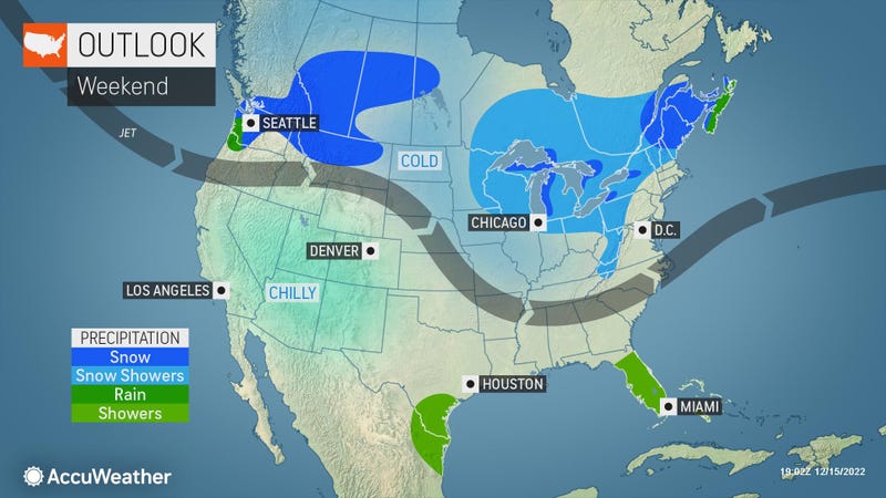
Temps will rise to around 45 in the city and nearby suburbs, but they’ll stay in the 30s to the north and west.
Friday night is brisk and chilly as clouds break for a mostly clear but colder weekend.
Highs will reach the low 40s on Saturday and the upper 30s on Sunday.
Monday is mostly sunny with a chilly breeze. The high will be 39.
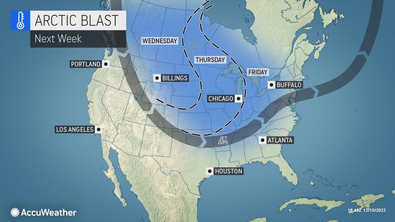
An arctic blast is in the forecast for next week. Highs will be in the upper 30s and low 40s on Monday, Tuesday and Wednesday, but they’ll plummet into the low 30s by Friday and to the 20s for Christmas weekend.
Related

Related

Related
