

NEW YORK (1010 WINS) -- Temperatures soared into the 60s in New York City on Thursday, breaking a 46-year-old record in Manhattan—but stormy weather with powerful wind gusts is in the forecast overnight into Friday.
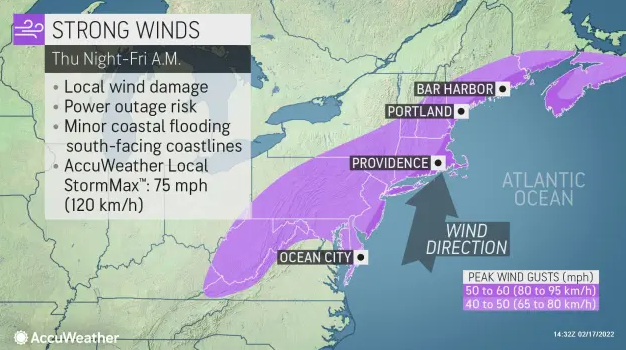
The National Weather Service issued a High Wind Warning for Nassau and Suffolk counties, as well as parts of coastal Connecticut starting at 11 p.m. Thursday and lasting until 10 a.m. Friday.
A Wind Advisory will be in effect for much of the rest of the Tri-State area during the same timeframe. The advisory includes all five boroughs and all of New Jersey, as well as the Lower Hudson Valley and southwestern Connecticut.
Thursday’s high reached 69 degrees in Central Park just before 3 p.m., breaking the previous record high for Feb. 17, which was 67 degrees in 1976, according to AccuWeather.
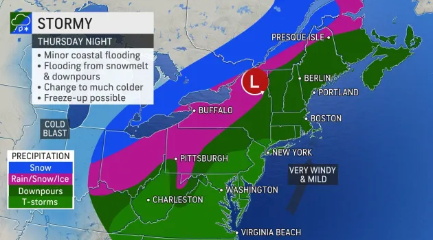
But increasing clouds on Thursday afternoon will mark a period of calm before the storm.
It becomes very windy Thursday night, with periods of windswept rain and powerful wind gusts that could top 50 mph in the city and 60 mph on Long Island.
Structural damage, coastal flooding and power outages are all possible from the storm, especially on Long Island. People should also watch for ponding water on roads and sidewalks through the overnight.
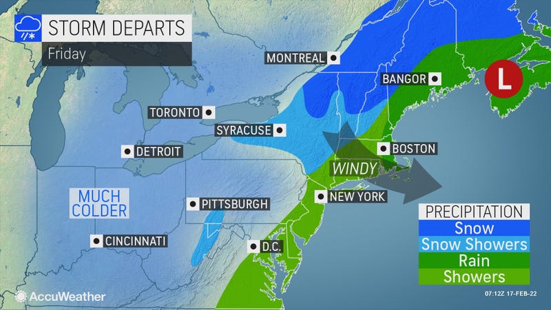
Temps will slowly fall through Friday, which starts gusty before sun returns in the afternoon. It will get down to 38 degrees in the city by 5 p.m. and will drop into the 20s overnight.

It’s chilly enough Saturday for a snow shower in the afternoon. The high will be 43.
Sunday is colder, with a high of 39, despite plenty of sunshine.
Presidents’ Day is dry and milder with highs in the mid-50s.
It will feel more like spring on a rainy Tuesday with highs in the upper 50s.
Related

Related
