
NEW YORK (1010 WINS) -- A major winter storm is dumping rain and then sleet and freezing rain on the New York City area Friday, threatening dangerous travel conditions and power outages as temperatures drop and surfaces ice over.
Winter weather advisories began Friday morning and will end around 11 p.m. for portions of northeast New Jersey and southeast New York, including New York City and Long Island, as the "marathon" storm moves through.
The National Weather Service continued to urge caution when traveling, as effects from winter weather canceled thousands of flights nationwide Thursday and Friday.
The city's Department of Sanitation issued a winter operations advisory for Friday due to the potential for ice accumulation and freezing conditions.

Alternate side parking is suspended through Saturday, and officials with the city's Emergency Management Department urged New Yorkers to use mass transit when possible and allow extra travel time.
The brunt of the storm was hitting Upstate, where over a foot of snow was recorded in the Finger Lakes and parts of central New York. A quarter of an inch of ice had accumulated in the Hudson Valley by Friday morning, and another quarter of an inch was expected throughout the day.
"It is a serious matter and we're not out of the danger zone yet," Gov. Kathy Hochul warned Friday. "And that is the seriousness of which we're approaching this to let everyone know we have the resources on the ground, but the weather is wildly unpredictable."
Over 55,000 customers were without power statewide, according to poweroutage.us.
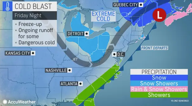
Rain will turn to sleet and freezing rain first in the northwest suburbs, according to AccuWeather. Inland areas of New Jersey and the Hudson Valley may see ice buildup and sleet accumulation early on.
The freezing line arrived in the city Friday evening, with temps plummeting to around 30 in midtown Manhattan by 5 p.m.
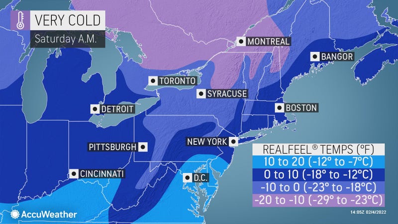
The temperature bottoms out at 22 in the city overnight Friday, with RealFeels falling into the single digits.
Surfaces will be icy and slippery as sleet and freezing rain mixes with melted snow from last week’s nor’easter.
After the storm passes, Saturday is blustery and cold despite some sun. The high will be 28.
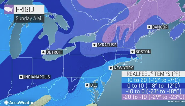
Sunday is partly cloudy and cold but not as harsh. The high will rise slightly to 31.
It’s milder to start the week—Monday and Tuesday will be dry with highs around 40.
Related
