
SAN FRANCISCO (KCBS RADIO) – The Bay Area has seen an impressive amount of wet weather for this time of year, especially at the coast, and more is expected on the way Sunday night.
For more, stream KCBS Radio now.
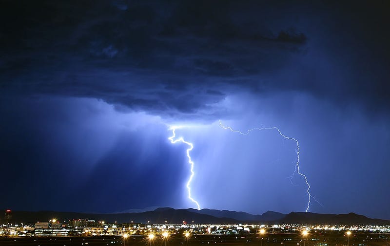
Isolated thunderstorms are possible Sunday night into Monday morning, bringing lightning, heavy rainfall and gusty winds, the National Weather Service forecast in a tweet.
Weather officials warned that a fire hazard is possible due to the potential lightning. People should also be wary of lightning strikes. Stay weather aware, the NWS said. When thunder roars, go indoors.
Isolated thunderstorms are possible from Napa down to Gorda on the Central Coast, encompassing the entire southern part of the Bay Area. A limited lightning risk will be present.
The weather is unexpected for the Bay Area, as the region experiences a rare wet summer.
Half Moon Bay is seeing its wettest July since 1975 and San Francisco is one hundredth of an inch away from breaking similar records.
The explanation lies in the desert southwest where it's monsoon season; the slightest shift in weather patterns and the monsoonal moisture finds its way to the Bay.
"It's not uncommon to see, especially during the summer months, an occasional night or morning with a little bit of light drizzle on the coast. This month specifically has been a bit more," National Weather Service Meteorologist Rick Canepa told KCBS Radio.
DOWNLOAD the Audacy App
SIGN UP and follow KCBS Radio
Facebook | Twitter | Instagram
Related
