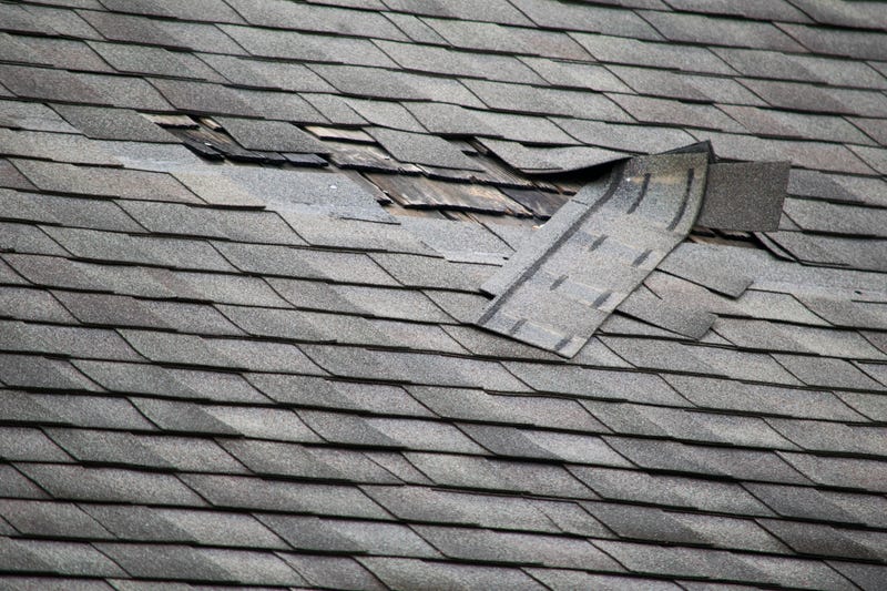

Severe weather moved through North Texas Thursday afternoon and evening, bringing high winds, and large hail, and causing significant damage in some areas.
At different times Thursday, parts of Dallas and Tarrant counties were under Tornado Warnings, but it was not immediately clear if a tornado formed.
Tornado Warnings were issued for parts of Dallas and Tarrant counties between 4:30 p.m. and 5:30 p.m. but were allowed to expire.
The biggest risk Thursday included hail and high winds.
Storms started to fire in the late afternoon Thursday as the dryline surged out of West Texas.
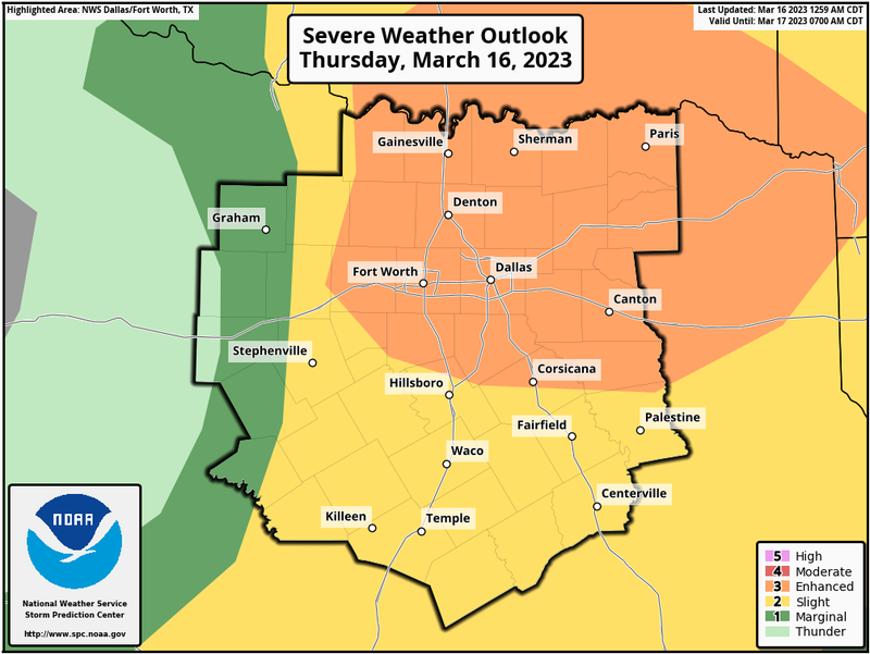
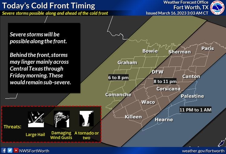
The cold front that was in the Texas Panhandle on Thursday morning approached after dinnertime and overtook the dryline after 6 p.m.
Strong, damaging wind, smaller hail, and an isolated tornado or two were the threats along the leading edge of this line of storms. It wasn't anything like last week when we saw the 80 mph wind across a good chunk of North Texas.
Once the wind shifts to the north, the severe threat will be over, but clouds and some showers will continue overnight. It will be very windy as well as temperatures tumble.
We'll wake up Firday to temperatures anywhere between 35 and 42゚ degrees with clouds sticking around. Wind chills will be in the upper 20s in some areas. Skies will clear after the noon hour, but temperatures will stay chilly with highs only in the low fifties, and wind chills will be in the 40s all day long.
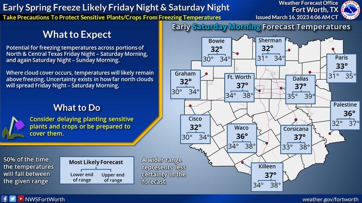
A light frost is possible on Saturday morning, with plenty of sunshine with high temperatures in the upper 50s by afternoon.
Another cold start for Sunday morning with readings between 32 and 37 degrees. Frost is unlikely because the wind will have picked up from the north again. A second cold front comes into the area during the morning hours. This will keep temperatures in the mid-50s for highs on Sunday with increasing clouds by evening.
There is a slight chance of showers on Monday with highs only in the low 50s, however, the majority of the rain should stay in Central and South Texas. There may even be some snow Friday through Sunday in the mountains of West Texas, where several inches may fall.
We clear out and warm up Tuesday and especially into Wednesday as temperatures get back into the 70s.
*Yest Rain: 0.00"; Yest High: 69; Low: 43
*Today’s Averages: High: 69; Low: 48
*Record high: 88 (1908); Record low: 29 (1947)
*March Rain: 1.35"; Deficit: 0.27"
*2023 Rain: 6.70"; Deficit: 0.21"
*Sunrise: 7:37am; Sunset: 7:37pm
Thursday: Morning showers, then partial clearing, then severe storms possible (3pm-10pm). Threats: Large hail, damaging winds, isolated tornadoes. Very windy. High: Upper 70s. Wind: South 20-30, G40 mph.
Thursday night: Showers and storms, some severe. Threats: Wind and small hail. Pressing south of DFW after 10pm. Turning windy and colder. Low: 38-43. Wind: North: 20-30, G40 mph.
Friday - St. Patrick's Day: Morning clouds, afternoon sunshine. Windy and Low 50s.colder. High: Low 50s. Wind: North 20-30, G35 mph.
Saturday: Morning freeze away from DFW. Partly cloudy and cool. High: Upper 50s.
Sunday: Increasing clouds, continued chilly. Slight chance of rain by evening. High: Low to mid 50s.
Monday: Mostly cloudy and cool. Slight chance of rain, better chances south. High: Low 50s.
Tuesday: Sunny and cool. High: Low to mid 60s.
Wednesday: Sunny, windy and warmer. High: Low 70s.
Related

LISTEN on the Audacy App
Tell your Smart Speaker to "PLAY 1080 KRLD"
Sign Up to receive our KRLD Insider Newsletter for more news