
As you probably know, Hurricane Idalia is the top story this morning. Unfortunately, this hurricane will not bring any rain to north Texas.
We have a very quiet weather pattern here across north Texas with temperatures remaining above average at least for the next week, as the ridge of high pressure starts to sneak back over the area. We have one thing in our favor, we continue to lose daylight as we work away into September. This will keep the mornings comfortable but the afternoons very hot.
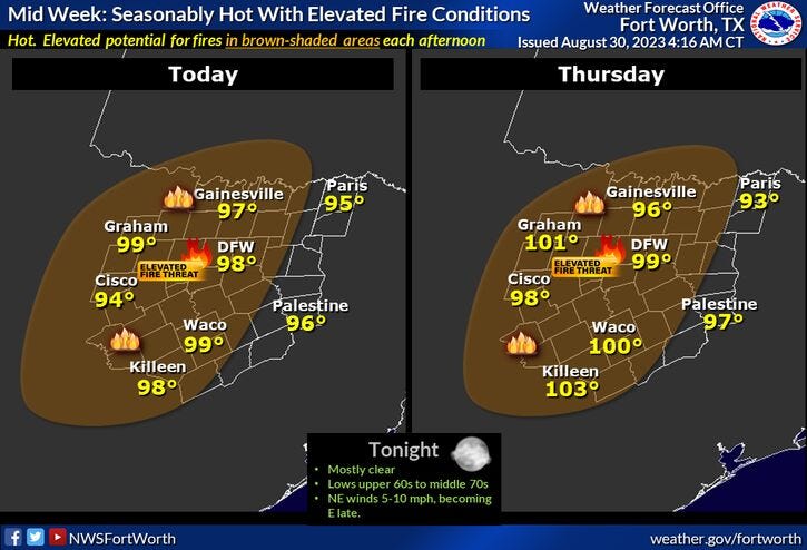
No Excessive Heat Warnings or Heat Advisories are in place as of now across north Texas, but we do have a very high grass fire danger today.
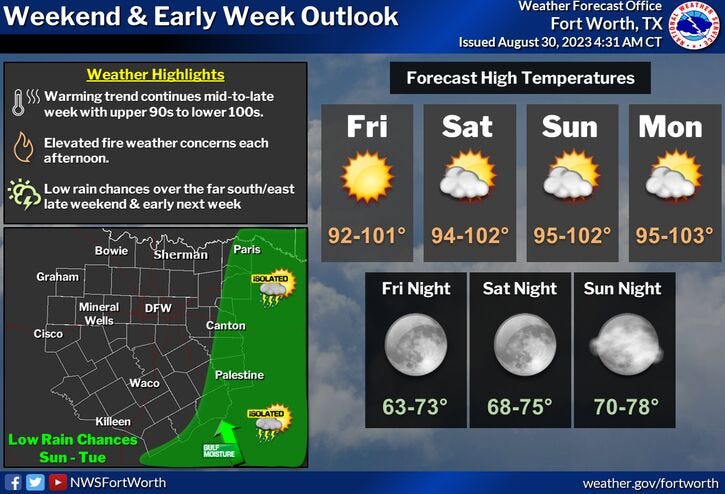
Temperatures will be flirting with the century mark today through Friday, as high as 102 to 103° through the holiday weekend. There will be a few scattered showers and storms Saturday and Sunday in far east Texas, but nothing for us.
This heat will continue through at least the middle of next week with afternoon highs at or slightly above 100°.
*Yest Rain: 0.00"; Yest High: 98; Low: 75
*Today’s Averages: High: 93; Low: 74
*Record high: 106 (1954): Record low: 59 (2000)
*August rain: Trace; Deficit: 2.00
*2023 Rain: 14.83"; Deficit: 9.54
*Sunrise: 7:01am; Sunset: 7:56pm
Today: Mostly sunny and hot. Low humidity. Grass fire danger. High: Upper 90s. Wind: NNE 10-20 mph.
Tonight: Clear and pleasant. Low: Low to mid 70s. Wind: ENE 5-10 mph.
Tomorrow: Mostly sunny and hot. High: Upper 90s. Wind: East 5-10 mph.
Friday: Sunny and hot. High: Near 100.
Weekend: Mostly sunny and hot. Isolated showers and storms EAST of DFW. High: Near 101.
Labor Day: Mostly sunny and hot. High: 103.
Monday and Tuesday: Sunny, continued hot. High: 102.
Related

LISTEN on the Audacy App
Tell your Smart Speaker to "PLAY 1080 KRLD"
Sign Up to receive our KRLD Insider Newsletter for more news
Follow us on Facebook | Twitter | Instagram | YouTube