
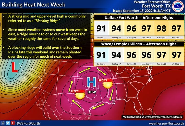
Above average temperatures and below average precipitation are in the cards for the next 7 to 10 days as a bubble of high pressure dominates our weather in the upper levels of the atmosphere.
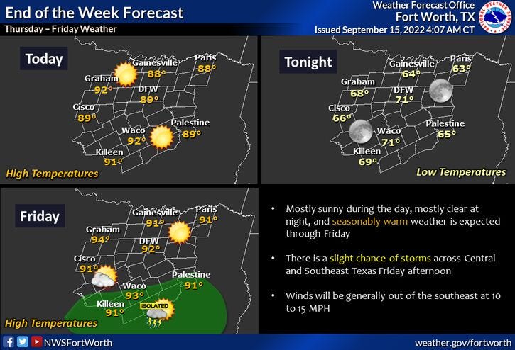
Good news is, we have another couple of cool mornings in store for us with temperatures in the 60s! Near average temperatures today and tomorrow with highs near 90° under a partly cloudy sky.
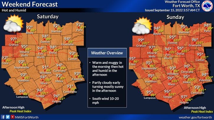
We slowly start to heat up this weekend and especially next week. Afternoon highs this weekend will be a bit toasty. Low 90s for Saturday, middle 90s for Sunday with some morning low clouds starting to sneak into the area as the humidity levels increase.
Hot and dry all of next week. Readings will reach the mid-90s during the day with morning lows and the low 70s. Our next possible pattern change won't arrive until that following weekend as a cold front will try to sneak into the area dropping temperatures and bringing a slight chance of rain with it.
Yest Rain: 0.00"; High: 88; Low: 64
*Today’s Averages: High: 89; Low: 69
*Record high: 100 (1965); Record low: 51 (1993)
*September rain: 0.33"; September deficit: 1.07"
*2022 Rain: 23.42”; 2022 deficit: 2.53"
*Sunrise: 7:12; Sunset: 7:34m
Today: *Air Quality Alert* Sunny and warm. High: Near 90. Wind: SE 5-10 mph.
Tonight: Clear and comfortable. Lows: 65-70. Wind: SE 5-10 mph.
Tomorrow: Mostly sunny and warm. High: Near 90. Wind: SE 10-15 mph.
Weekend: Partly cloudy and hot. Highs: Low to mid 90s.
Monday - Wednesday: Partly cloudy and hot. Highs: Mid to upper 90s.
Related

LISTEN on the Audacy App
Tell your Smart Speaker to "PLAY 1080 KRLD"
Sign Up and Follow NewsRadio 1080 KRLD