
Hot and dry, that's our weather story for the next several days! Unfortunately, this ridge of high pressure in the upper levels of the atmosphere will dominate our weather for the next seven to nine days.
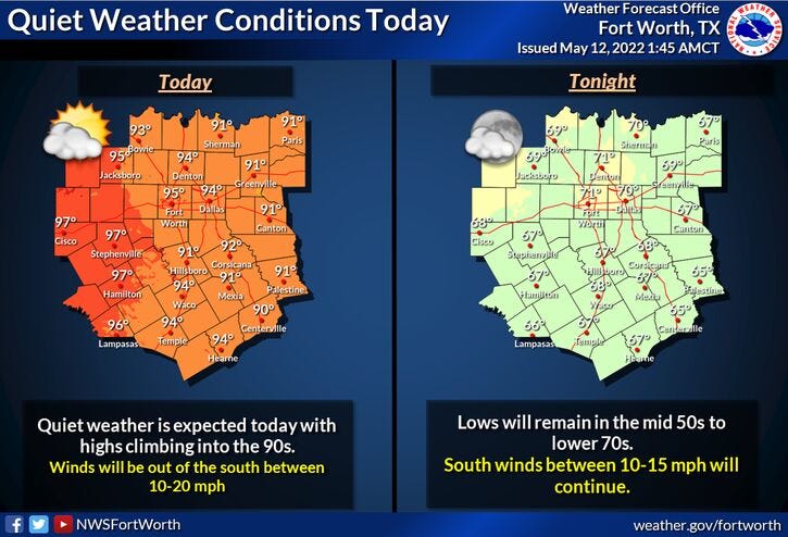
Afternoon highs today and tomorrow willl reach the low to mid 90s, with morning lows in the 70s.
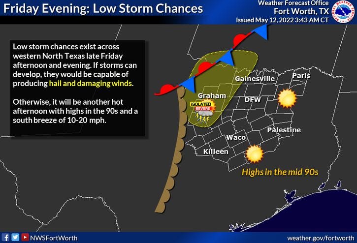
There is a very slight chance of a late evening shower and storms west of DFW and then south of the area on Saturday, but chances are very slim.
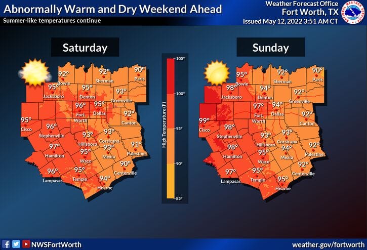
We'll also have near record breaking heat starting Sunday into Monday and Tuesday with afternoon highs into the upper 90s. Morning lows will be in the low 70s. This very hot weather pattern for this time of the year will continue all the way through the end of next week.
Please remember to stay hydrated and take frequent breaks if you're going to be working outdoors.
Our next weather change is due to arrive in about nine days. Some of the extended model data has a cold front coming through the area, increasing our rain chances and cooling our temperatures down by next weekend.
*Yest Rain: 0.00”; *Yest High: 90; Low: 72
*Today’s Averages: High: 82; Low: 63
*Record high: 98 (1978); Record low: 44 (1960)
* May rain: 1.63”; May deficit: 0.02”
*2022 rain: 8.40”; 2022 deficit: 5.06"
*Sunrise: 6:30am; Sunset: 8:19pm
Today: *Air Quality Alert* Sunny, windy and HOT. High: Low to mid 90s. (Record 98 degrees). Heat index near 100. Wind: SSW 15-25 mph.
Tonight: Partly cloudy, breezy, mild and muggy. Low: Low 70s. Wind: SSW 15-25 mph.
Tomorrow: Mostly sunny. Hazy, hot, breezy and humid. Slight evening storm chance (west of Fort Worth). High: Mid 90s (Record 95 degrees). Wind: SSE 15-25 mph.
Weekend: Sunny, breezy, hot, and hazy. Lower humidity. Near record highs. Highs: Mid 90s.
Monday - Wednesday: Sunny, hot, and hazy. High: Upper 90s.
Related

LISTEN on the Audacy App
Sign Up and Follow NewsRadio 1080 KRLD