
Today or most likely tomorrow will be the last of the heat warnings and advisories for north and east Texas for a while, as this upper level ridge of high pressure shifts off to our east! Plus, a few of you will see a storm or two in your backyard through next Wednesday.
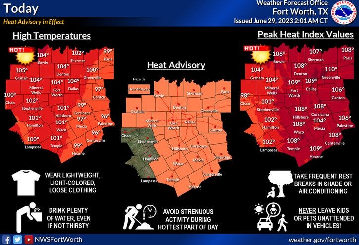
We're waking up to temperatures near 80° this morning under a clear sky. A heat advisory is in effect today, as the heat index exceeds 105° in areas. Surface temperature will level off between 101° and 103°.
Friday will be a degree of two cooler with high temperatures near 100° under a clear sky.
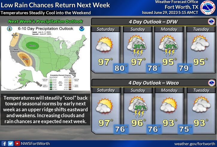
Temperatures will continue to trend downward this weekend through the middle of next week. There's also a chance for a late day and early evening shower and storm each day, but most will stay dry.
Afternoon highs will warm into the mid nineties through the period.
I wouldn't cancel your outdoor plans over the extended holiday timeframe, but please monitor the weather. Remember, if you hear thunder, get off and out of the water immediately.
*Yest Rain: 0.00"; Yest High: 101: Low: 79
*Today’s Averages: High: 94 Low: 74
*Record high: 108 (1980): Record low: 62 (1985)
*June Rain: 0.78"; Deficit: 2.71
*2023 Rain: 14.36"; Deficit: 5.72
*Sunrise: 6:23am; Sunset: 8:41pm

Today: *Heat Advisory* Sunny, breezy and hot.. High: 101-103. Heat index: 105+. Wind: SSW 10-20 mph.
Tonight: Clear and warm. Low: 78-82. Wind: South 10-20 mph.
Friday: *Possible Heat Advisory* Sunny, breezy and hot. High: Near 100. Heat index: Near 105. Wind: SSW 10-20 mph.
Saturday and Sunday: Partly cloudy and a tad cooler. Isolated late day storms. High: Mid to upper 90s.
Monday: Partly cloudy and warm. Isolated late day showers and storms. High: Mid 90s.
4th of July: Partly cloudy and warm. Isolated late day showers and storms. High: Mid 90s.
Wednesday: Partly cloudy and warm. Isolated late day showers and storms. High: Upper 90s.
Related

LISTEN on the Audacy App
Tell your Smart Speaker to "PLAY 1080 KRLD"
Sign Up to receive our KRLD Insider Newsletter for more news