
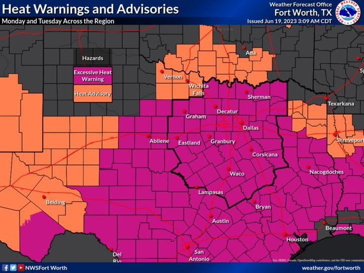
There are Excessive Heat Warnings for North Texas Monday and Tuesday before temperatures get slightly cooler Thursday and Friday. There will be slight storm chances Monday night, late Wednesday, and late Thursday before triple-digit heat returns into the weekend.
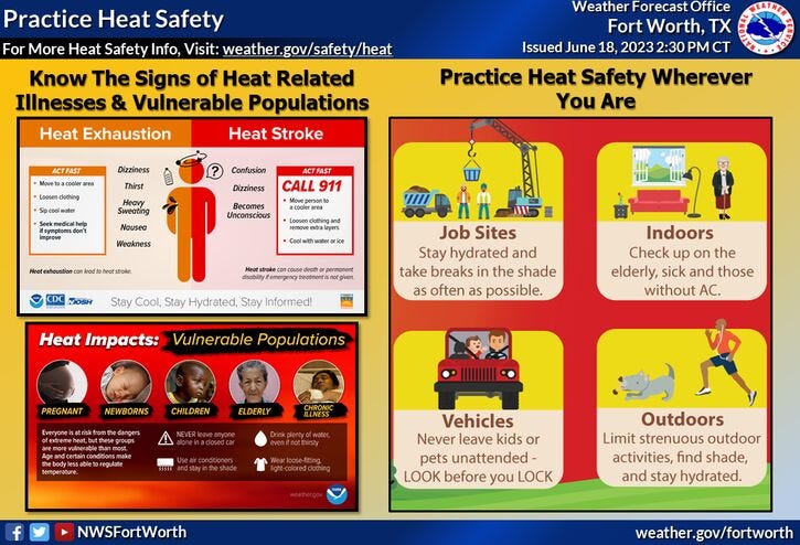
Serious heat Monday through Wednesday with afternoon highs that will approach 100 degrees. When you factor in the oppressive humidity it'll feel more like 110 to 115 degrees. Please take the necessary precautions, especially if you're working outdoors.
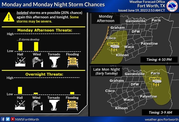
A few lucky ones may see a few storms west of DFW Monday evening as the dry line approaches. There's also another slight chance of storms east of DFW overnight as a disturbance dives out of Oklahoma. Hail and gusty wind will be the threats. Again, chances are very slim.
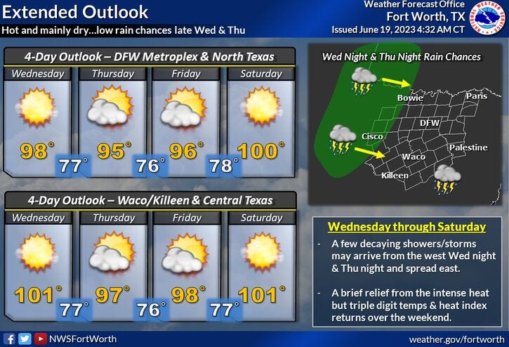
This ridge of high pressure will back a little bit to the west of North Texas on Thursday and Friday, dropping temperatures into the mid-90s for afternoon highs. There's also a slight chance of storms late Wednesday and again late Thursday. The threats are hail and gusty wind.
Unfortunately, this ridge of high pressure builds back across North Texas this weekend, with afternoon highs near 100 degrees on Saturday, and around 102 degrees on Sunday. Heat index values may exceed 110 degrees.
Please stay cool and hydrated my friends and try to enjoy the weather when you can, it's the only weather you've got!
7-Day Headlines:
* DFW reached 94 degrees Sunday.
* Excessive Heat Warning Monday and Tuesday.
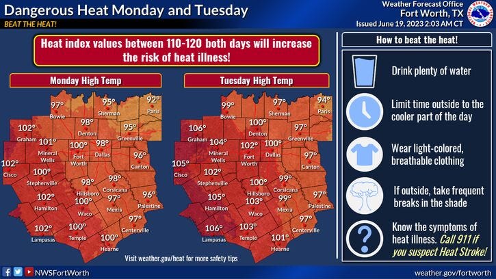
* Heat index values 110+ degrees.
* Slight storm chance Monday night.
* Summer officially arrives at 9:58 a.m. Wednesday.
* Slightly cooler Wednesday - Friday.
* Slight storm chance late Wednesday and Thursday.
* At or above 100 degrees this weekend. Heat indices 110+.
*Sunday Rain: 0.00"; Sunday High: 94; Low: 75
*Monday's Averages: High: 92; Low: 73
*Record high: 103 (1980): Record low: 56 (1912)
*June Rain: 0.63"; Deficit:
*2023 Rain: 14.21"; Deficit:
*Sunrise: 6:20am; Sunset: 8:39pm
Monday: *Excessive Heat Warning* Mostly sunny, hazy, and hot. High: Upper 90s. Heat index: 110+. Wind: SSE 5-10 mph.
Monday night: Partly cloudy, warm, and muggy. Isolated storms. Low: Mid to upper 70s. Wind: SE 5-10 mph.
Tuesday: *Excessive Heat Warning* Mostly sunny, hazy, and hot. High: Near 100. Heat index: 110+. Wind: SE 5-10 mph.
Wednesday: *Summer arrives at 9:58 a.m.* Mostly sunny, hot and humid. Slight chance of storms towards midnight. High: Upper 90s. Heat index: 108-112.
Thursday: Mostly sunny, hot, and humid. Slight chance of storms after midnight. High: Mid-90s.
Friday: Mostly sunny, hot, and humid. High: Mid-90s.
Weekend: Mostly sunny, hot, and humid. Highs: 100-103.
Related

LISTEN on the Audacy App
Tell your Smart Speaker to "PLAY 1080 KRLD"
Sign Up to receive our KRLD Insider Newsletter for more news