
We broke record high temperatures on Saturday and Sunday, and more records will be broken this week. We're now sitting at 40 triple-digit days so far this year. That ranks tenth all time.
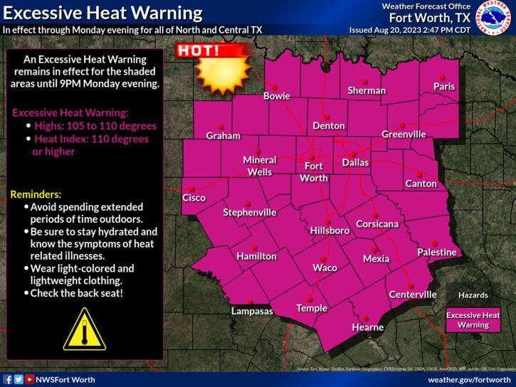
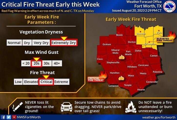
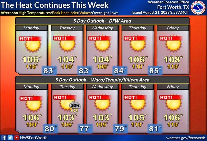
We're starting Monday with a clear sky and temperatures in the upper 70s to mid 80s. Another Excessive Heat Warning is in effect for today. We also have a Red Flag Warning in effect. Today's record high is 105°. I'm forecasting a high of 107°. Also, the grass fire danger is very high today and tomorrow.
Tuesday and Wednesday will be a few degrees cooler with highs around 104°. Unfortunately, temperatures will increase again Wednesday and especially Thursday through the weekend. Wednesday's high: 105°. Thursday near 106°. Friday and Saturday as high as 109° and 107° on Sunday. Records may be broken Thursday through Sunday once again.
No rain is in the forecast through Saturday. There is a slight chance of rain late Sunday, but that's still days away and is subject to change.
A quick look at the tropics. An area of low pressure continues to move westbound out of the eastern Gulf of Mexico this morning. The Hurricane Center is giving this a 70% chance of becoming a possible named storm (Harold) by late tonight or tomorrow morning as it approaches the lower Texas coast. Unfortunately, this system won't bring any rain to North Texas. The rain will be confined to areas south of I-10.
*Yest Rain: 0.00"; Yest High: 109R; Low: 83
*Today’s Averages: High: 95; Low: 75
*Record high: 105 (1948): Record low: 62 (1927, 1940)
*August rain: Trace; Deficit: 1.25
*2023 Rain: 14.83"; Deficit: 8.79
*Sunrise: 6:55am; Sunset: 8:07pm
Today: *Excessive Heat and Red Flag Warnings; Air Quality Alert* Sunny, breezy and hot. Grass fire danger. Record heat. High: 107 (Record is 105). Wind: East 10-20, G25.
Tonight: Clear, breezy and warm. Low: 78-85. Wind: SSE 10-20, G25 mph.
Tuesday: Sunny, breezy and hot. Grass fire danger. Near record heat. High: 104 (Record is 105). Wind: East 10-20 mph.
Wednesday: Sunny and continued hot. High: 104 (Record is 107).
Thursday: Sunny and hot. Near record heat. High: 106 (Record is 106).
Friday: Sunny and very hot. Record heat. High: 109 (Record is 106).
Saturday: Sunny and very hot. Record heat. High: 109 (Record is 106).
Sunday: Sunny, continued hot. Slight chance of rain late. Near record heat. High: 107 (Record is 107).
Related

LISTEN on the Audacy App
Tell your Smart Speaker to "PLAY 1080 KRLD"
Sign Up to receive our KRLD Insider Newsletter for more news