
We hope you enjoyed the 88° high on Sunday. We won't feel that until possibly this weekend, as a cold front cools this off "briefly" and may bring some rain with it as well.
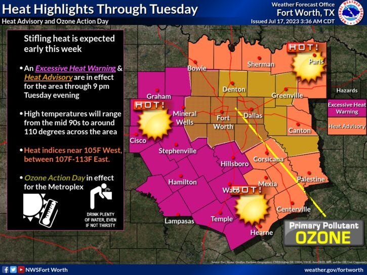
We're starting Monday with pleasant temperatures across north Texas. Readings have fallen into the low to mid 70s. You won't enjoy the Heat Advisories and Warnings that are in place across north Texas through Thursday. Afternoon highs today will range between 102° and 106° from east to west. The feels-like temperature (heat index) will approach 110° in the warning areas, which doesn't include Dallas and Fort Worth.
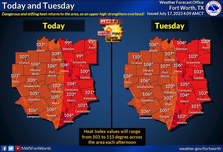
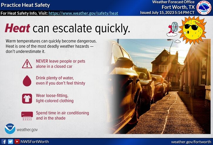
The two hottest days this week will be Tuesday and Wednesday as the mercury sores up to 103 to 109° from east to west. At least the humidity levels will be tolerable during the afternoon hours. Heat index values will approach 110° in areas. Please drink plenty of water and take frequent breaks if you're working outdoors. FACT: You can get heat exhaustion by sitting in the shade without drinking water.
This ridge of high pressure will back off to the southwest of us late this week and into the weekend, allowing a northerly flow to develop in the upper levels of the atmosphere. This will drive a cold front through north Texas by Friday evening. This front may produce some scattered showers and storms through Saturday evening. It'll also cool temperatures down to near 100 for a high on Friday, 94 on Saturday, 97 on Sunday, average for this time of the year. Unfortunately, this ridge of high pressure builds back across north Texas into next week, bringing triple digits back to the area.
So far, we've experienced 10 triple digit days this year, we'll reach 14 days by Thursday, and we will approach 20 days by the end of next week. That's right at average for a summer in Texas. And unfortunately, we still have August to deal with.
*Yest Rain: 0.32; Yest High: 88 Low: 74
*Today’s Averages: High: 96; Low: 76
*Record high: 109 (1980): Record low: 65 (1900)
*July Rain: 0.47"; Deficit: 0.86
*2023 Rain: 14.83"; Deficit: 6.79
*Sunrise: 6:32am; Sunset: 8:37pm
Today: *Heat Advisories and Warnings* ** Air Quality Alert** Sunny, hot and hazy. High: 102-106. Heat index Near 110. Wind: SW 5-10 mph.
Tonight: Clear and warm. Low: 78-82. Wind: SSE 10-15 mph.
Tomorrow: *Heat Advisories and Warnings* Sunny, breezy, hot and hazy. High: 104-108. Heat index: Approaches 110 degrees. Wind: SSW 15-25 mph.
Wednesday: *Heat Advisories and Warnings* Sunny, breezy, hot and hazy. High: 104-108. Heat index: Approaches 110 degrees. Wind: SSW 15-25 mph.
Thursday: Sunny, breezy and hot. High: 102-105.
Friday: Partly cloudy, not as hot. Afternoon cold front. A few storms possible late. High: 95-100.
Saturday. Partly cloudy and seasonable. A few showers and storms. High: Low to mid 90s.
Sunday: Sunny, heating back up. High: Mid 90s. Triple digits return all of next week.
Related

LISTEN on the Audacy App
Tell your Smart Speaker to "PLAY 1080 KRLD"
Sign Up to receive our KRLD Insider Newsletter for more news