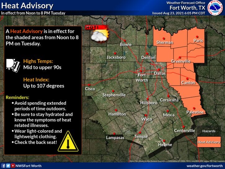

Welcome to the last week of August! And mother nature is showing no mercy with heat advisories just east of DFW today and most likely tomorrow.
Afternoon highs will be in the upper 90s today and tomorrow, mid 90s Thursday-Saturday and low 90s for Sunday and Monday of next week.
Some of you lucky ones may see a late day shower storm as soon as Thursday and Friday, especially east and south of DFW. A little bit better chance of scattered storms as we work our way into Sunday and Monday of next week, as daytime highs will only be in the low 90s by then.
The ridge of high pressure anchored over the south central plain states right now will shift into the eastern United States by early next week. This may drive an area of disturbed weather presently in the eastern Caribbean, NW into the Gulf of Mexico by early next week. Residents along the Gulf Coast need to monitor the tropics next week.
*Yest Rain: 0.00”; *Yest High: 97; Low: 75
*Today’s Averages: High: 95; Low: 75
*Record high: 106 (2011); Record low: 60 (1961)
*August rain: 4.82”; August surplus: +3.34”
*2021 Rain: 26.84”; 2021 surplus +2.99”
*Sunrise: 6:58am; Sunset: 8:03pm
Today: *Heat Advisory, just east and north of DFW* …Mostly sunny and hot. High: Upper 90s. Heat index: Near 104. Wind: South 5-10 mph.
Tonight: Clear and muggy. Low: Mid to upper 70s. Wind: South 5-10 mph.
Tomorrow: Mostly sunny and hot. High: Upper 90s. Heat index: Near 104. Wind: South 5-10 mph.
Thursday and Friday: Mostly sunny and hot. Isolated late day showers and storms. High: Mid to upper 90s. Heat near 102 degrees.
Weekend: Partly cloudy, hot and humid. A bit cooler, with a slight chance for a late afternoon storm. High: Low to mid 90s.
Monday: Partly cloudy, hot and humid. Slight chance for a late day storm. High: Low to mid 90s.
Related

LISTEN on the Audacy App
Sign Up and Follow NewsRadio 1080 KRLD