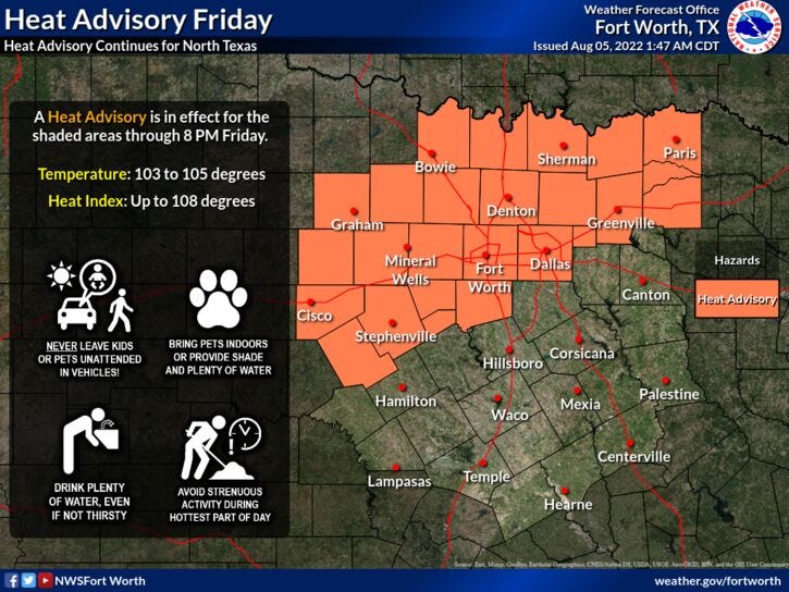

We're waking up to temperatures near 80° once again with one loan shower working its way near the Parker and Palo Pinto County line. That's it! We do have a couple of more chances for some isolated showers and storms today and then again tomorrow, with afternoon highs around 102° today, near 100 tomorrow. There's also a Heat Advisory in effect for areas northwest of Interstate 30 today as well.
Sunday and Monday look dry with high around 100° on Sunday, 102° on Monday. By Tuesday and Wednesday, isolated showers and storms return to the forecast during the late afternoon and early evening hours. High temperatures will hover near 100°. No rain is in the forecast for Thursday.
I'm keeping this discussion short and sweet with no 100° stats, because I'm sure you're tired of hearing about it. I do want to mention there's a high grass fire danger for the foreseeable future.
Related

LISTEN on the Audacy App
Sign Up and Follow NewsRadio 1080 KRLD