
A large ridge of high pressure in the upper levels of the atmosphere will dominate North Texas weather over the next seven days. Although we do not have heat advisories across North Texas, they do extend from East Texas all the way into Iowa and to the Missouri and Mississippi river valleys.
I am expecting Heat Advisories to be issued for North Texas by the middle to end of this week and extend into the weekend.
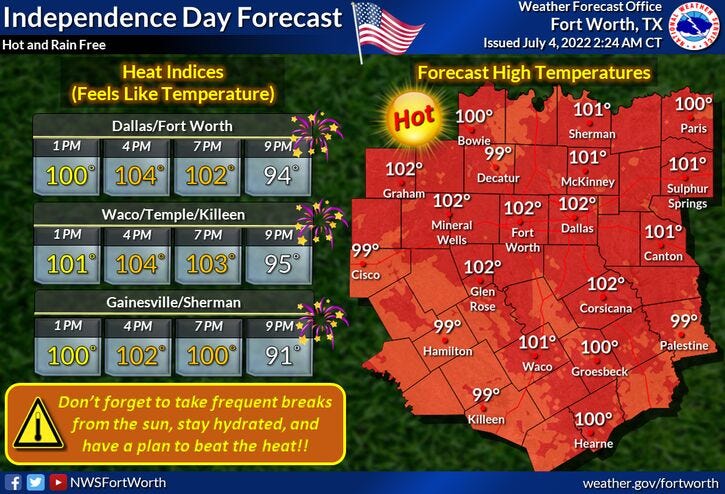
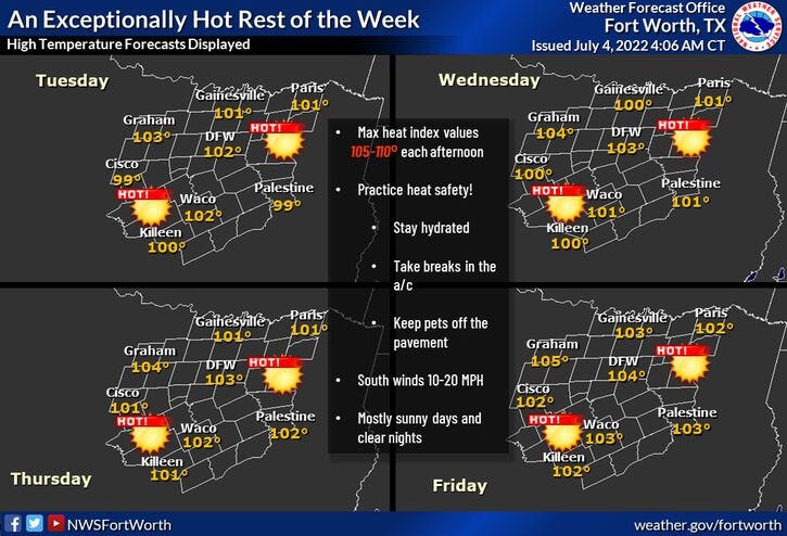
Afternoon highs will be at or above 100 for the next seven days. The temperature will be 101 to 103 Monday and Tuesday. It will be 102 to 104 Thursday and Friday, and 104 to 106 on Saturday and Sunday. A possible pattern change may develop by this time next week.
Have a great safe Independence Day and enjoy the weather, when you can, it's the only weather you've got.
7-Day Headlines:
* Yesterday’s high at DFW: 101 degrees.
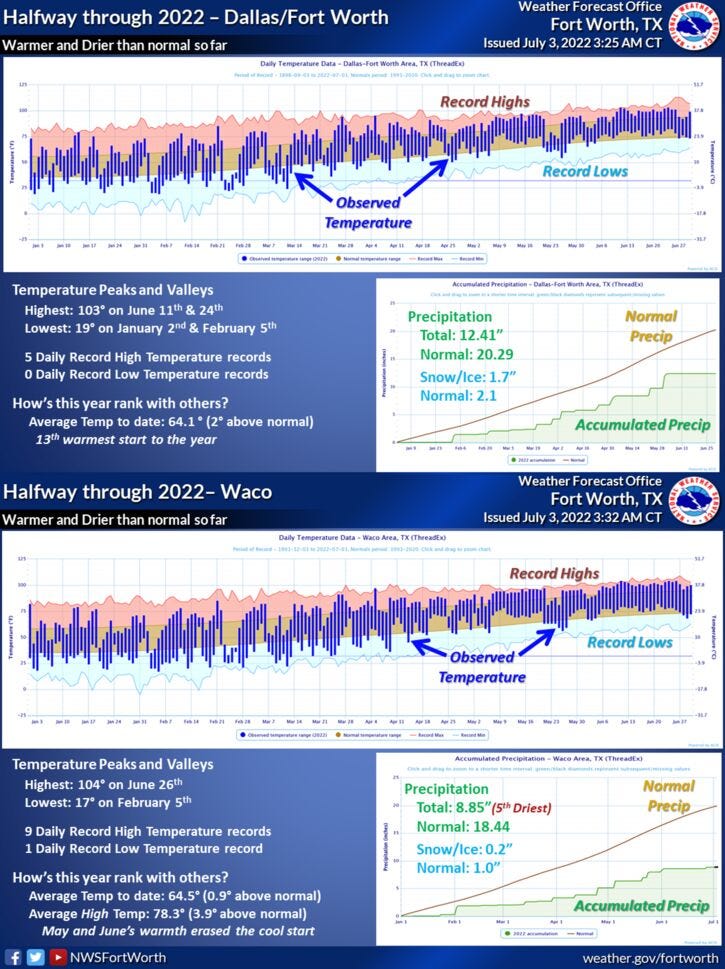
* 16th warmest start to the year.
* Rainfall: 8.19” below average.
* Its been 30 days without measurable rain at DFW.
* No rain in our 7 day forecast.
* 100+ degree heat through the weekend.
* Heat Advisories coming soon.
*Yest Rain: 0.00”; *Yest High: 101; Low: 73
*Today’s Averages: High: 94; Low: 75
*Record high: 105 (1996); Record low: 60 (1924)
* July rain: 0.00”; July deficit: ”>.
*2022 rain: 12.41”; 2022 deficit ”>
*Sunrise: 6:25am; Sunset: 8:40pm
Today: Partly cloudy and hot. High: 99-102. Heat index 104. Wind: SSW 10-20 mph.
Tonight: Fair, muggy and warm. Low: Near 80. Wind: SSE 10-20 mph.
Tomorrow: Sunny and hot. High: 101-103. Heat index 105. Wind: SSE 10-20 mph.
Wednesday - Friday: Sunny and hot. Possible heat Advisories. Highs: 102-104.
Weekend: More of the same. Sunny and hot. Highs: 102-105.
Related
LISTEN on the Audacy App
Sign Up and Follow NewsRadio 1080 KRLD