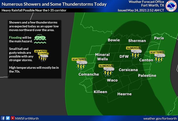

An upper level disturbance around San Antonio will quickly drift to the north through the day today. Widespread shower and non severe thunderstorm activity will spread into the area from the south by this afternoon. Some areas may pick up a quick inch or 2 with some isolated higher totals possible. This will cause creeks and streams to come out of their banks again and cause flooding in low lying areas. Please turn around... don't drown. Highs today will be in the mid to upper seventies.
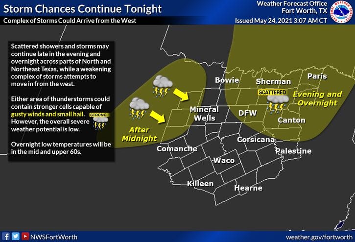
I think we get a break in the rain by mid to late evening, but another batch of storms will form in the Texas panhandle will rapidly head our direction before daybreak... in a weakened state. Isolated severe with small hail and damaging wind is possible a good 60 to 100 miles northwest of DFW, but the storms may weaken as they approached a little before daybreak.
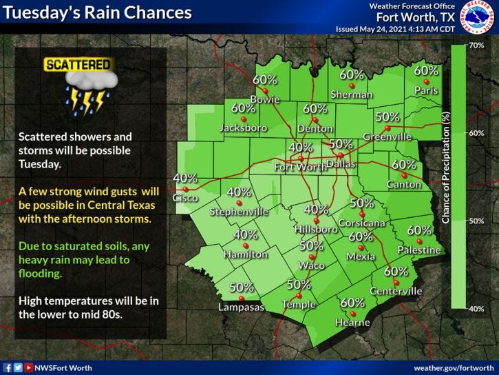
More scattered showers and storms will develop by Tuesday afternoon, but will be less numerous. Some areas may creep close to 80゚
I believe we dry out a little bit Wednesday and Thursday with highs in the low, possibly mid eighties if we see some sunshine. The air will be so thick you'll be able to cut it with a knife. More bad hair days ladies!
Then all eyes shift to the northern sky both Friday and Saturday morning. Areas of showers and storms will form across the high plains of Kansas and Colorado late Thursday and Friday afternoon. These storms will move southbound with a northwesterly flow in place. Some noise is possible both mornings, but nothing too severe expected. I'll keep an eye on things just in case.
Most of the weekend looks OK with decreasing clouds Saturday... highs in the low to mid eighties.
Partly cloudy warm and very humid Sunday, with readings in the upper eighties. Some areas might touch 90゚ but heat index values will be well up into the nineties on Sunday.
7-Day Headlines:
* Heaviest rain totals today. Some flooding.
* Scattered showers and storms tomorrow.
* Drying out a bit Wed and Thursday.
* More scattered storms by weeks end.
* Heating up a bit this weekend.
__________________________________________________________
*Yest Rain: 0.02”; *Yest High: 77; Low: 69
*Today’s Averages: High: 86; Low: 67
*Record high: 96 (1996); Record low: 54 (1940)
___________________________________________________________
*May rain: 4.99”; May surplus: +1.40”
*2021 Rain: 15.59”; 2021 surplus: +0.19”
*Sunrise: 6:24am; Sunset: 8:27pm
___________________________________________________________
Today: Cloudy and humid. Rain picks up this afternoon. Areas of flooding possible. High: Mid 70s. Wind: SE 5-10 mph.
Tonight: Cloudy and muggy. Chance of showers and storm. Low: Upper 60s. Wind: SE 5-10 mph.
Tomorrow: Mostly cloudy and humid. Scattered showers and storms by afternoon. Nothing severe. High: Near 80. Wind: SE 10-20 mph.
Wednesday: Morning showers and storms, becoming partly cloudy, warm. High: Low to mid 80s.
Thursday: Partly cloudy, warm and humid. High: Mid 80s.
Friday and Saturday: Partly cloudy, warm and humid. Scattered showers and storms return. Highs: Mid to upper 80s.
Sunday: Partly cloudy, warm and humid. High: Near 90.
LISTEN on the Audacy App
Sign Up and Follow NewsRadio 1080 KRLD
Facebook | Twitter