
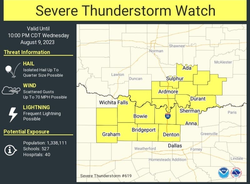
UPDATE: A Severe Thunderstorm Watch has been issued for some parts of North Texas until 10 p.m. Wednesday evening. Counties affected include Denton, Wise and Cooke, according to the National Weather Service.
I'm watching a cluster of strong the severe thunderstorms that will continue to move east across far north Texas. The strongest storms will stay north of highway 380.
I'm also watching an area of storms out west of us towards Graham and Abilene. These have formed along the cold front as well. These will be drifting east through the evening hours. Hoping they survive as they approach the 35W corridor. All model data has them weakening once they move east of 35W... unfortunately, the front will stall and move back to the north tomorrow.
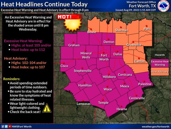
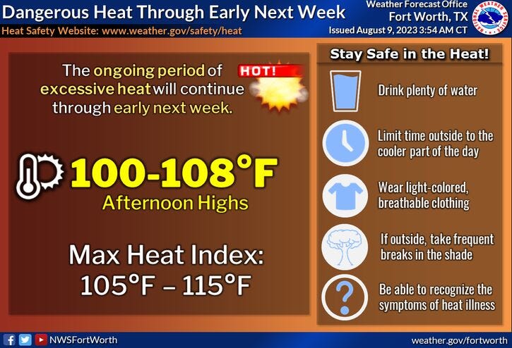
There is no relief from the heat over the next 7 days, as Excessive Heat Warnings and Advisories will continue into early next week.
We're waking up to temperatures in the upper 70s to mid 80s. There's also a few dying showers north of DFW this morning. Unfortunately, these showers are moving to the NE away from DFW.
Mostly sunny, windy and hot today with afternoon highs between 103° and 108°. The hottest temperatures will be west of I-35W. Southwesterly winds will gust as high as 30 mph creating a very high grass fire danger today, mainly west of I-35W.
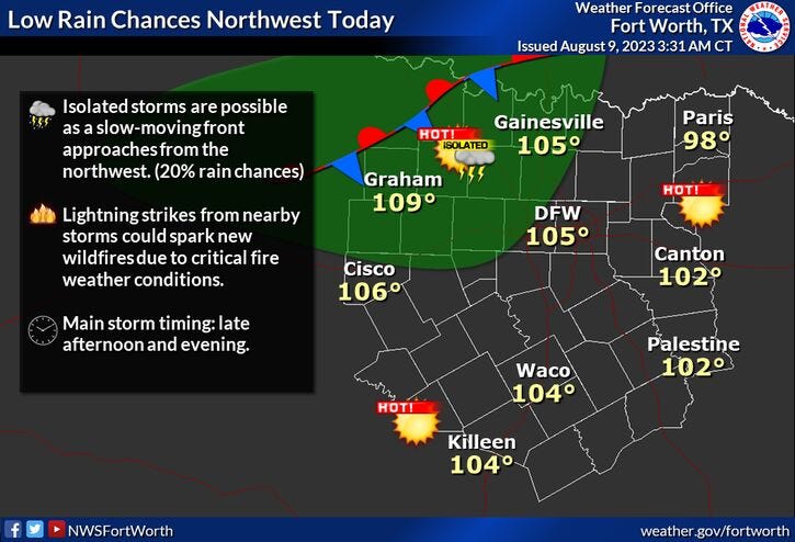
I'll also be keeping my eye on a weak cold front that'll approach and then stall NW of DFW this evening into tomorrow, bringing a slight chance of showers and storms with it. Coverage will be about 20%. Not expecting much in the way of rainfall across the Metroplex.
This ridge of high pressure will strengthen over the area Friday through next Tuesday. More Excessive Heat Warnings are likely, the grass fire danger will continue (mainly west of I-35W) and near record heat is possible this weekend though early next week. Afternoon highs will range between 104° and 108° from east to west across the area.
*Yest Rain: Trace; Yest High: 103 Low: 86
*Today’s Averages: High: 97; Low: 77
*Record high: 108 (2012): Record low: 60 (1989)
*August Rain: 0.00"; Deficit: 0.48"
*2023 Rain: 14.83"; Deficit: 8.02"
*Sunrise: 6:47am; Sunset: 8:20pm
Today: *Excessive Heat Warning* A few morning sprinkles, then partly cloudy, windy and hot. Isolated evening storms. High grass fire danger. High: 105. Wind: SSW: 15-25, 30 mph.
Tonight: Partly cloudy, warm and windy. An isolated shower or storm. Low: 78-85. Wind: SSW: 15-25 mph.
Thursday: *Excessive Heat Warnings likely* Mostly sunny, breezy and hot. An Isolated late day storm, mainly north of DFW. High grass fire danger. High: 105. Wind: SSW 10-20 mph.
Friday-Sunday: *Excessive Heat Warnings likely* Mostly sunny, windy and hot. Grass fire danger. Highs: 104-108.
Monday and Tuesday: More of the same. Mostly sunny, breezy and hot. Grass fire danger. Highs: 102-106.
Related

LISTEN on the Audacy App
Tell your Smart Speaker to "PLAY 1080 KRLD"
Sign Up to receive our KRLD Insider Newsletter for more news