
Boy it sure feels nice out this morning! Temperatures have fallen into the sixties across much of North Texas at this hour! We can thank yesterday's cold front for our pleasant start!
Low humidity and warming temperatures is our weather story through the upcoming weekend. High pressure in the upper levels of the atmosphere will nose its way in from the northwest. This northwesterly flow will also bring smoke from the Western wildfires into north Texas tomorrow through the weekend. So expect some pretty wild sunrises and sunsets. As of now, no air quality alert is an effect.
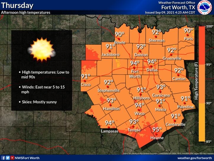
Today will be the coolest day through Sunday, with afternoon highs in the low nineties. We're back in the sixties tonight under a fair sky. Temperatures warm up into the low to mid nineties tomorrow, mid to upper nineties into the weekend. The hottest temperatures will be northwest of DFW.
Next week, the wind flow in the upper levels and at the surface will become southeasterly. Also, an area of disturbed weather will move into the Texas coast off the Gulf of Mexico, with a lot of rain in their forecast. This moist flow from the Southeast will bring low clouds our direction each morning through midweek. Depending on how long the clouds stick around each morning will depend on how warm we get in the afternoon. Some of this coastal rain may sneak up into our area on Tuesday, especially east of DFW.
By Wednesday, I'll be tracking a cold front heading in from the north. That combined with the moisture to our south may produce widespread shower and thunderstorms all across north Texas.
Temperatures will be a little cooler with highs and the upper eighties on Wednesday. Possibly low to mid eighties by next Thursday as cooler air comes into the area.
In the meantime, please stay cool and hydrated, because summer is still holding on across north Texas through the weekend.
*Yest Rain: 0.09”; *Yest High: 94; Low: 69
*Today’s Averages: High: 91; Low: 71
*Record high: 101 (1954); Record low: 55 (1956)
*September rain: 0.18”; September deficit: 0.60
*2021 Rain: 27.02”; 2021 surplus +1.69”
*Sunrise: 7:08am; Sunset: 7:42pm

Today: Mostly sunny, breezy and hot. Low humidity. High: Low 90s. Wind: East 10-20 mph.
Tonight: Fair and cool again. Low: 65-70. Wind: Variable 5-10 mph.
Tomorrow: Sunny, hazy and hot. High: Mid 90s. Wind: SE 10-15 mph.
Weekend: Mostly sunny, hazy windy and hot. High: Mid to upper 90s.
Monday and Tuesday: Mostly cloudy, windy, more humidity, but not as hot. A few showers and storms on Tuesday. High: Near 90.
Wednesday: Mostly cloudy, warm and humid. Scattered showers and storms. High: Upper 80s.
Related

LISTEN on the Audacy App
Sign Up and Follow NewsRadio 1080 KRLD