
Thursday starts with a few clouds, an east wind, and pleasant temperatures. Readings have fallen into the low to mid sixties away from town, near seventy in the immediate Dallas/Fort Worth area.
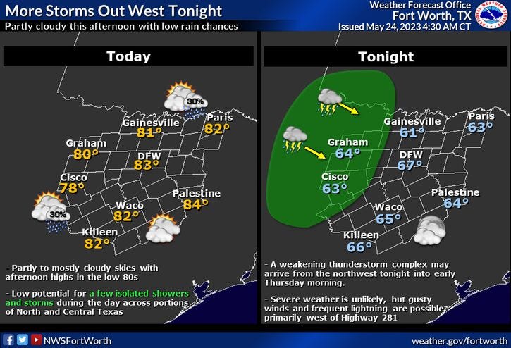
There's also an area of showers and storms well to the west and NW of us at this morning. Unfortunately they will not be moving into North Texas and will die out over the next few hours. We will see plenty of sunshine today, warm and hazy with afternoon highs in the mid 80s.
Another area of storms will form a good 400 miles to the west of us this evening. Some of these storms may skirt our western counties around daybreak Friday, but most stay dry.
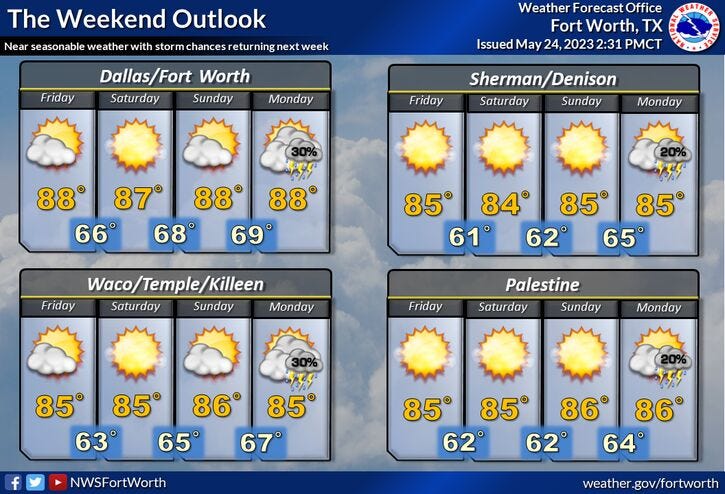
Friday through Sunday weather looks nice, with afternoon highs in the mid to upper 80s. There could be a few late evening storms on Sunday.
I'm putting scattered showers and storms back in the forecast during the evening hours Memorial Day through Wednesday of next week. Afternoon highs will creep into the upper eighties to near ninety degrees by Wednesday.
*Yest Rain: 0.00"; Yest High: 87; Low: 67
*Today’s Averages: High: 87; Low: 68
*Record high: 97 (1980): Record low: 51 (1979)
*May Rain: 2.11"; Deficit: 1.63"
*2023 Rain: 13.34"; Deficit: 2.21"
*Sunrise: 6:23am; Sunset: 8:27pm
Today: Partly cloudy, hazy and warm. High: Mid 80s. Wind: East 5-10 mph.
Tonight: Partly cloudy and nice. Slight chance of decaying storms west of I-35W by daybreak. Low: Mid to upper 60s. Wind: East 5-10 mph.
Tomorrow: Morning showers (west), then mostly sunny and warm. High: Mid 80s.
Saturday: Partly cloudy and seasonable. High: Mid 80s.
Sunday: Partly cloudy and warm. Isolated late evening showers and storms. High: Upper 80s.
Related

LISTEN on the Audacy App
Tell your Smart Speaker to “PLAY 1080 KRLD”
Sign Up and Follow NewsRadio 1080 KRLD
Facebook | Twitter | Instagram