
7-Day Headlines:
* DFW reached 60 degrees yesterday...0.00" of rain.
* Protect plants/pets overnights through the weekend.
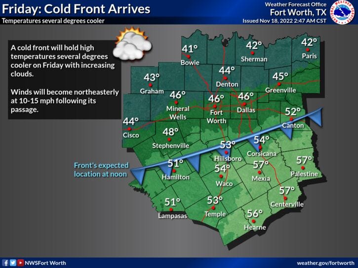
* Morning cold front, increasing clouds.
* Cooler today through the weekend.
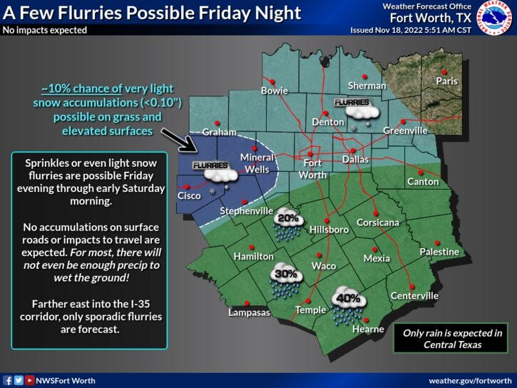
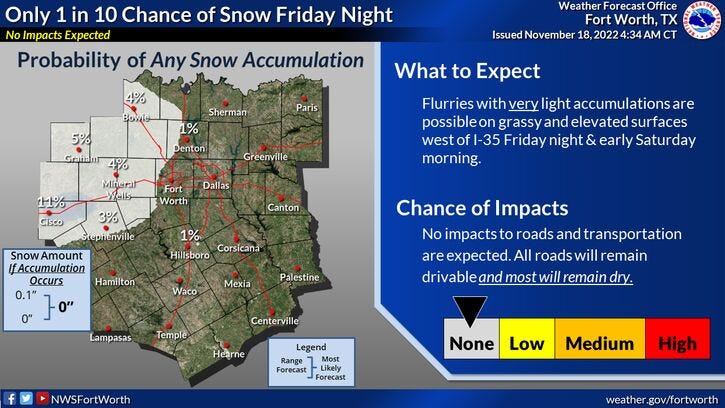
* Snow flurries possible after midnight through 8am Saturday.
* First offical freeze Sunday morning.
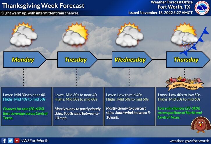
* Slow warm up next week.
_________________________________________________________
*Yest Rain: 0.00"; High: 60; Low: 34
*Today’s Averages: High: 66; Low: 45
*Record high: 83 (1973); Record low: 20 (1903)
_________________________________________________________
*November rain: 4.01"; Surplus: 2.43"
*2022 Rain: 31.86”; 2022 deficit:
*Sunrise: 7:01am; Sunset: 5:25pm
________________________________________________________
Today: Morning cold front, increasing clouds. Colder air oozes in. High: Mid to upper 40s. Wind: NNE 10-15 mph.
Tonight: Cloudy and cold. A slight chance of light snow north of I-30 (between midnight and 8am). Light rain south and east. Protect plants and pets. Wind: NNE 5-10 mph.
Tomorrow: Morning flurries, staying cloudy though mid afternoon. Decreasing clouds by evening. Staying chilly. High: Mid to upper 40s. Wind: NE 5-10 mph.
Sunday: Mostly sunny, continued cool. Increasing clouds by evening. High: Near 50.
Monday: Mostly to partly cloudy and cool. Slight chance of morning showers. High: Low to mid 50s.
Tuesday: Partly cloudy and a bit warmer. High: Upper 50s.
Wednesday: Mostly cloudy. Slight chance of showers. High: Low 60s.
Thanksgiving: Increasing clouds. Watching for possible rain chances. High: Near 60.
Several times since records have been kept, we have had measurable snow/sleet in November. The latest decent event was in 1994, when we saw two inches of sleet on Thanksgiving. I'm sure some of you remember that crazy Cowboys/Miami game. Does Leon Lett come to mind?
Breaking it down for you, another shot of cold air has arrived. Clouds will continue to increase through the day today and temperatures will hold steady in the mid 40s.
Clouds will thicken overnight, and areas of light rain and light snow will develop towards midnight tonight across North Texas. Right now, I'm thinking between midnight and 6:00 a.m. is our best chance to see any type of light precipitation. But, due to the air being so dry, a lot of this will evaporate before it reaches the ground. It's not out of the questions that some light snow flurries will fall, especially along and north of Interstate 30 during this time frame. As of now, I'm not expecting any accumulations, with the exception of the Red River counties and areas west of Interstate 35W. These areas could see a light dusting on rooftops and grassy surfaces by daybreak. Again, the majority of this will evaporate before it reaches the ground.
Skies will slowly clear by tomorrow afternoon and evening, but temperatures will remain chilly. Morning lows will be in the low to mid 30s tomorrow with afternoon highs in the low to mid 40s. We'll approach 50 degrees by Sunday. A warming trend is expected as we approach Thanksgiving.
I'm going to keep an eye on the radar trends after midnight tonight and will go live on FB in the middle of the night if I see some flakes flying. I might even take a drive in my truck with my high beam headlights on so you can see the snow.
Related

LISTEN on the Audacy App
Tell your Smart Speaker to "PLAY 1080 KRLD"
Sign Up and Follow NewsRadio 1080 KRLD