
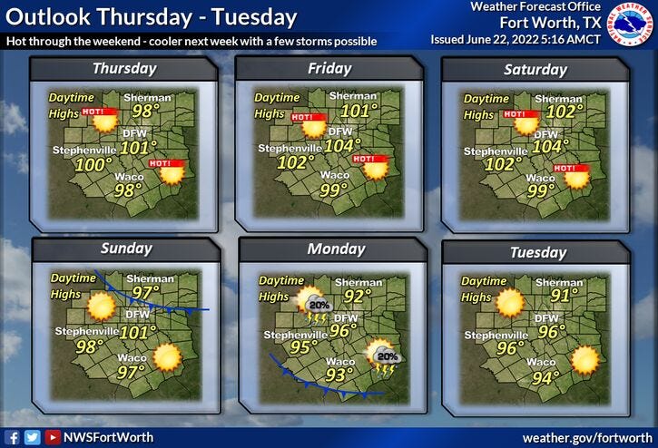
Triple-digit heat remains in the forecast through Sunday and then cooler weather with some rain possible late Sunday into Monday.
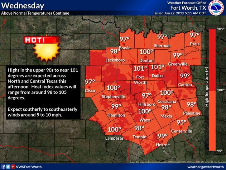
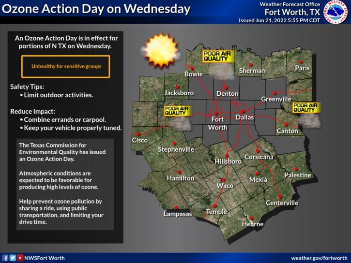
We're starting off in the mid-to-upper 70s again this morning under a fair sky. Another sunny and hot day is ahead with afternoon highs near 100 degrees. Wind will be from the south at 5 to 10 mph, therefore, another Air Quality Alert is in effect for today.
For tonight, clear skies with morning lows dropping between 75 and 80 degrees.
Possible Heat Advisories may be issued Thursday through Saturday. Temperatures will warm to 101 tomorrow, 103 on Friday, and 104 on Saturday. Heat index values will be 105+.
Things start to change by late Sunday but not before we hit 100° again. Clouds will increase by evening and there's a pretty decent shot of showers and thunderstorms by late evening through Monday morning. Right now, I'm going with a high of 90 degrees on Monday.
A few leftover showers and storms, mainly south of DFW on Tuesday, with highs in the low 90s. Unfortunately, the triple-digit heat will return by the end of next week.
*Yest Rain: 0.00”; *Yest High: 99; Low: 81
*Today’s Averages: High: 93; Low: 73
*Record high: 103 (1936, 1953); Record low: 58 (1902)
* June rain: 2.64”; June deficit: 0.02"
* 2022 rain: 12.41”; 2022 deficit: 6.72"
* Sunrise: 6:21am; Sunset: 8:40pm
Today: *Air Quality Alert* Sunny and hot. High: Near 100. Heat index 104. Wind: SE 5-15 mph.
Tonight: Clear and warm. Low: 75-80. Wind: SE 5-10 mph.
Tomorrow: Sunny and hot. High: 101. Heat index 104. Wind: SE 5-10 mph.
Friday and Saturday: Sunny and VERY hot. Highs: 102-105.
Sunday: Increasing clouds and hot. Late day cold front produces scattered showers and isolated thunderstorms by evening. High: Near 100.
Monday: Partly cloudy and cooler. A few leftover showers and storms, especially south of DFW. High: Near 90.
Tuesday: Partly cloudy and seasonable. Low humidity. High: Low 90s.
Related

LISTEN on the Audacy App
Sign Up and Follow NewsRadio 1080 KRLD