
Our unseasonably hot weather pattern will continue for the next seven to nine days, as a strong upper level ridge of high pressure dominates our weather.
We're starting off this morning in the lower 70s. Afternoon highs today will reach the low to mid 90s.
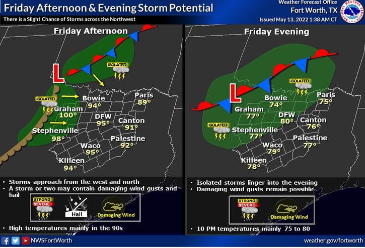
By this evening, an area of showers and thunderstorms along a slow moving stalling cold front will sag our direction. A few of these storms may hold together and move into DFW towards midnight, but nothing severe is expected.
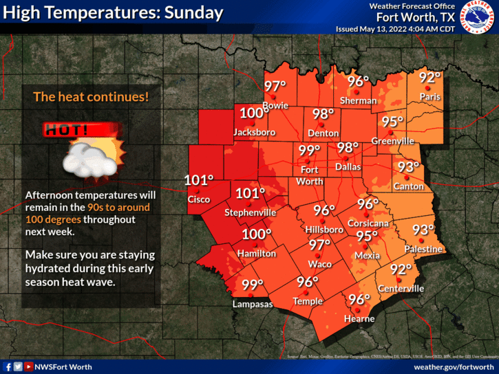
After that, the faucet shuts off and the heat is on. Record heat starts tomorrow and lasts all the way through next week. Highs tomorrow will reach the low to mid 90s... upper 90s Sunday through Friday of next week.
A possible break in the heat and maybe some rain and cooler temperatures arrive by next weekend.
*Yest Rain: 0.00”; *Yest High: 92; Low: 71
*Today’s Averages: High: 83; Low: 64
*Record high: 95 (1956); Record low: 43 (1971)
* May rain: 1.63”; May deficit: 0.18”
*2022 rain: 8.40”; 2022 deficit: 5.22"
*Sunrise: 6:30am; Sunset: 8:19pm
Today: Mostly sunny, windy and hot. High: Low to mid 90s. (Record 95 degrees). Wind: SSE 15-25 mph.
Tonight: Increasing clouds. Slight chance of showers and storms. Low: Low 70s. Wind: SSW 15-25 mph.
Tomorrow: Mostly sunny and hot. Near record highs. High: Mid 90s (Record 95 degrees). Wind: SSE 15-25 mph.
Sunday: Sunny, breezy, hot, and hazy. Near record highs. Highs: Upper 90s (Record 94 degrees).
Monday - Thursday: Mostly sunny, breezy and hot. Near record highs. Highs: Upper 90s.
Related

LISTEN on the Audacy App
Sign Up and Follow NewsRadio 1080 KRLD