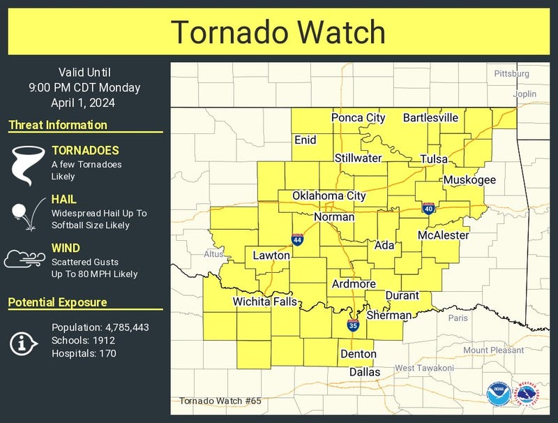

A Severe Thunderstorm Watch remains in effect for parts of North Texas until 1 a.m. Tuesday. That Watch includes Collin, Ellis, Kaufman and Rockwall counties. A Tornado Watch has also been issued for Denton County until 12 a.m. Tuesday.
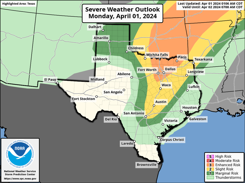
The threat of severe storms ramps up this afternoon through the evening. It won't be a widespread event, but any storms that do form and break the cap along the dryline are capable of producing large hail. The tornado threat is low across North Texas. The greater tornado threat will be up along the Red River and in the eastern half of Oklahoma.
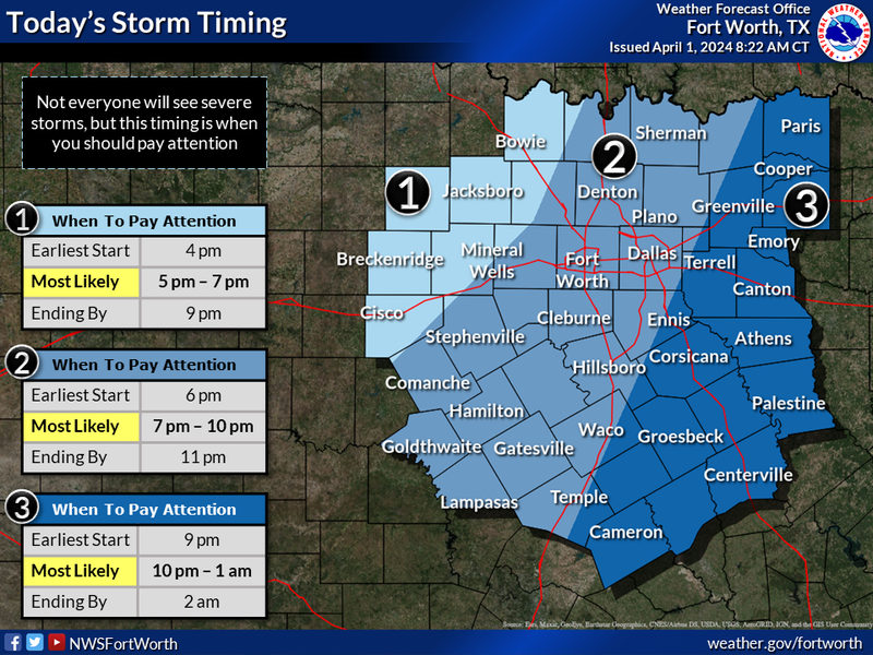
The window for scattered severe storms across the Dallas-Fort Worth area will be between 7:00 p.m. and 10:00 p.m. earlier to the west and later to the east.
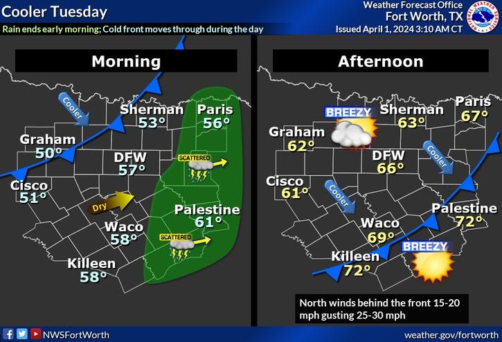
There may be a few breaks in the clouds this afternoon, especially west of the Dallas-Fort Worth area. Afternoon highs will reach the low 80s. After the storms move east of us overnight, a cold front will arrive tomorrow morning. There will be some wrap-around clouds as well as a bunch of wind and cooler temperatures. Afternoon highs will hold steady in the low 60s.
We'll start off in the 40s on Wednesday morning with afternoon hides near 70°. Mid-70s on Thursday and near 80 on Friday as south winds pick up.
There's a slight chance for showers and storms late Saturday evening as a weak cold front approaches. The severity looks low at this time. Afternoon highs will be in the upper 70s.
After some morning clouds on Sunday, slightly dry air will filter into the area during the day. Partly cloudy with highs in the upper 70s once again.
We're still a week away from the total eclipse across north Texas. As of now, it's going to be a race between low clouds surging in from the south Monday morning and how much dry air filters in on Sunday. It's very difficult to pinpoint such a small window for the eclipse this far out, but as of now, it looks like the low clouds may make it into the area before the eclipse starts. That would not be good, but again, we're still a week away and I will continue to update this forecast as we work our way through the week.
*Yest Rain: 0.00"; Yest High: 78; Low: 66
*Today’s Averages: High: 73; Low: 52
*Record high: 93 (1918); Record low: 31 (1899)
*March Rain: 5.66"; Surplus: 2.36"
*2024 Rain: 10.80"; Surplus: 2.21"
*Sunrise: 7:15am; Sunset: 7:49pm
LISTEN on the Audacy App
Tell your Smart Speaker to "PLAY 1080 KRLD"
Sign Up to receive our KRLD Insider Newsletter for more news
Follow us on Facebook | Twitter | Instagram | YouTube