
August has come and gone, as our meteorological summer has come to an end. It was the fourth hottest on record. We can thank La Nina for that. We also experienced the wettest August on record as well with 10.68" of rain. That usually doesn't happen during a La Nina year.
Now it's time to transition towards fall this month. It officially starts on September 22nd. Temperatures will continue to trend downward and we'll continue to lose daylight hours pretty quickly as we approach the winter solstice in December. This also means another severe weather season coming up late this month through October into early November. I'm hoping it stays quiet.
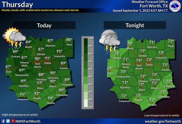
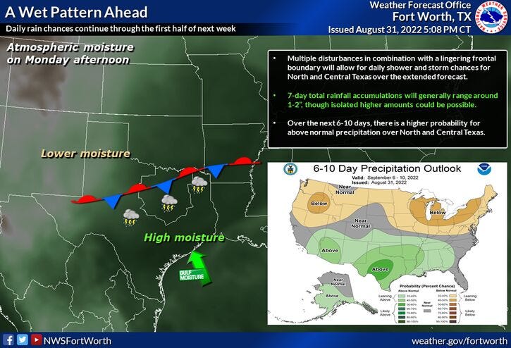
Now, let's talk about your 7-day forecast. A system working its way from northwest to southeast will impact our weather today, creating widespread shower and thunderstorm activity between noon and 9:00 p.m. Very heavy rain, dangerous lightning, and gusty wind are the threats. if you see training of thunderstorms in your backyard, you could pick up three to four inches of rain. Most areas will pick up between a half inch to an inch of rain. Please turn around and don't drown! Localized flash flooding is a big concern.
Afternoon highs may reach 90° in some areas before the rain hits. Please keep in mind, a few of you may not see a drop but that's just the way things work sometimes.
Your holiday weekend is looking okay. Tomorrow through Monday, isolated afternoon and evening thunderstorms will be the weather story. Afternoon highs will reach the upper 80s with a ton of humidity. Heat index values will be in the mid-90s.
More of the same for next Tuesday and Wednesday, with afternoon highs in the upper 80s. The threat for isolated afternoon and evening storms will continue.
*Yest Rain: 0.15"; *Yest High: 90; Low: 74
*Today’s Averages: High: 93; Low: 73
*Record high: 109 (2000); Record low: 59 (1915)
*August rain: 10.53"; August surplus: 8.50"
*2022 Rain: 12.84”; 2022 deficit: 1.46"
*Sunrise: 7:03am; Sunset: 7:53pm
Today: Partly to mostly cloudy and muggy. Scattered showers and storms. Pockets of VERY heavy rain (noon - 9pm). High: Upper 80s. Wind: North 5 mph.
Tonight: Mostly cloudy and muggy. a few leftover showers. Low: Low to mid 70s. Wind: Lt. Var.
Tomorrow: Mostly to partly cloudy and muggy. Scattered showers and storms. Best chance south of DFW. High: Mid to upper 80s. Wind: Lt. Var.
Saturday - Labor Day: Partly cloudy, warm and humid. Isolated afternoon and evening showers and storms. Best chances south of DFW. Highs: Upper 80s.
Monday - Wednesday: Partly cloudy, warm and humid. Isolated afternoon and evening showers and storms. Highs: Upper 80s.
Related

LISTEN on the Audacy App
Tell your Smart Speaker to "PLAY 1080 KRLD"
Sign Up and Follow NewsRadio 1080 KRLD