
AUSTIN (Talk1370.com) -- Austin and parts of Central Texas will be under the gun for possible severe weather Tuesday night into Wednesday morning.
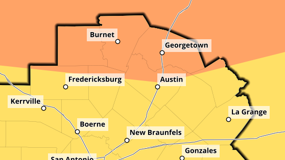
The latest update to the Storm Prediction Center's severe weather outlook for Tuesday night into Wednesday morning moves an Enhanced risk, or a 3 out of 5, to include much of Central and North Texas, including the northern half of the Austin metro.
The biggest risk will be strong, straight-line winds as a squall line of storms is expected to develop ahead of an approaching cold front. Those storms are expected to begin pushing into the Hill Country by 9 p.m., approaching the I-35 corridor by midnight, and pushing through the area to our east by sunrise.
In addition to the strong winds, small hail and an isolated tornado are also possible.
Widespread rain totals of 1-3" are likely, with some isolated totals up to 4" possible as these storms move through.
The passing cold front will drop temperatures into the lower 80s Wednesday, before a warming trend returns temperatures back into the 90s by the weekend.