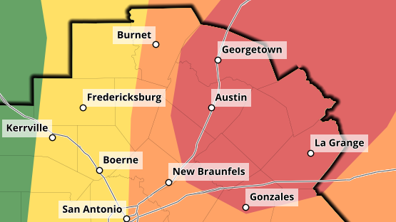

AUSTIN (Talk1370.com) -- The threat for severe weather continues to increase Monday afternoon across the Austin metro, with much of the Austin area now in a moderate risk for large hail, strong winds, and tornadoes.
A Tornado Watch is in effect for all of the Austin metro until 10 PM tonight...
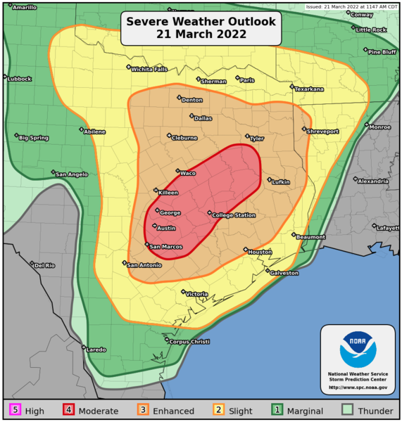
An afternoon update from NOAA's Storm Prediction Center places much of the City of Austin and Travis County, along with parts of Hays County and points north and east in the moderate risk zone - the fourth of five levels of severe risk.
Storms are expected to develop as a dryline and cold front approach the area, with the largest threat for the IH-35 corridor expected between 5 and 7 p.m.
Related

Scattered showers and even an isolated thunderstorm or two will be possible Monday morning into the early afternoon hours, before stronger storms are expected to develop in the Hill Country as the dryline approaches.
The biggest threat from these storms will be for large hail, possibly 2" in diameter or higher, with an additional risk for strong, straight-line winds and even a 10% chance for EF2 or stronger tornadoes within 25 miles of any given point in much of the Austin metro.
The severe storms are expected to push through our eastern counties by later Monday evening. Some isolated, non-severe storms could be possible as the cold front pushes through later tonight.
Stay with Talk 1370 and Talk1370.com for the latest on this developing severe weather situation.