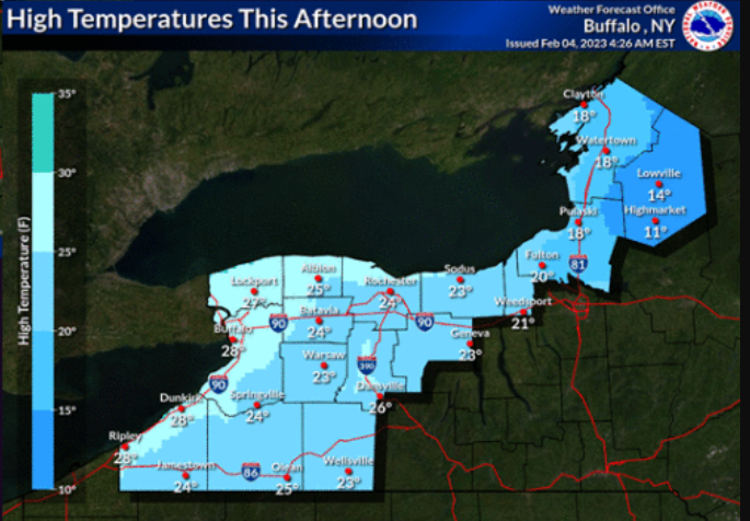

Buffalo, N.Y. (WBEN) - After another bitter cold start Saturday morning, temperatures will recover to more normal values and make way for a return to a more moderate winter pattern for Western New York.
Bitterly cold air still in place Saturday morning will quickly move out later today, with above normal temperatures returning Sunday and lasting through all of next week, according to forecasters at the National Weather Service in Buffalo.

Dry weather will prevail Saturday afternoon through early Sunday afternoon, then a weak cold front will bring a few rain and wet snow showers late Sunday afternoon, changing to all snow Sunday night through early Monday with minor accumulations possible.
Wind Chill Advisories in place the past couple days will expire mid Saturday morning after the region wakes up to single digit temperatures and subzero wind chills that will quickly exit the region as the weekend progresses.