
Buffalo, N.Y. (WBEN) - The "Luck of the Irish" delivered a record high temperature for Buffalo on Sunday, despite being spoiled by a round of rain and gusty storms that moved through during the afternoon hours.
"We did manage to set a high temperature record in Buffalo yesterday at 75 degrees," National Weather Service meteorologist Phillip Pandolfo tells WBEN. "The previous record was only 70 degrees set back in 1990."
The thermometer also hit 75 on Friday, Pandolfo noted.
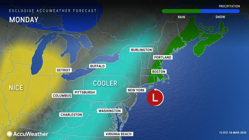
Temperatures on Monday will be much cooler than recent days, with a few lingering rain and wet snow showers giving way to clearing in the afternoon.
High pressure will build into the Eastern U.S. and bring dry weather Monday night through Wednesday, with a notable warming trend through midweek
"For the foreseeable future, at least through our seven-day forecast, we expect a lot more in terms of up and down temperatures," Pandolfo said. "Today does look to be one of the coldest days in our seven-day forecast."
Temperatures will hover in the 30s across most of Western New York.
We'll be on the 'up' side of the equation beginning Tuesday, however. Expect highs to reach the upper 50s to lower 60s in most locations. It will be notably cooler along the Lake Erie and Lake Ontario shores.
"We'll be warming right back up again tomorrow, and especially Wednesday, we could be seeing temperatures back in the 70s before cooling off again," Pandolfo predicts.
Temperatures will again cool down late Thursday and into Friday. "We could be seeing an additional batch of rain changing over to snow," Pandolfo warns.