
Buffalo, N.Y. (WBEN) - Mother Nature has 'snapped' her fingers and, just like that, we've transitioned from an unseasonably warm summerlike pattern to more normal fall conditions in a matter of hours.
Overnight rain will clear away midday Friday and temperatures, while cooler, won't be shockingly colder after the frontal passage.
"We'll still be close to 70 for a high today, but then the cooler air comes in in earnest later tonight and Saturday," National Weather Service meteorologist John Hitchcock tells WBEN.
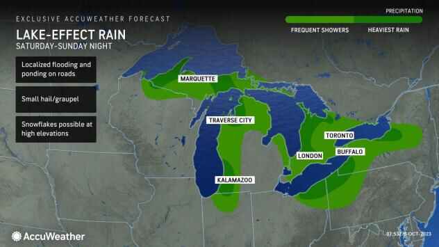
Temperatures Saturday will only make it to the upper 50's with lake effect rain showers across the Buffalo-Niagara region. Low 50's are the forecast high for Sunday and Monday.
"We're going from summer to almost early November-like weather," Hitchcock says. High temperatures Sunday will be 30 or more degrees cooler than what we experienced during the balmy conditions Thursday.
It will be a wet weekend with lake effect rain showers more prevalent across the Buffalo area Saturday morning, then drier in the afternoon hours. Showers are also likely at times Sunday.
"Not a washout by any means over the weekend," Hitchcock noted.
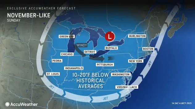
Because of the extent of clouds and breezes around the clock, this pattern will not bring the lowest nighttime temperatures of the season yet to most places from the Great Lakes to the interior Northeast. Dry air, a clear sky and calm conditions at night allowed temperatures to dip into the 30s and 40s over the interior several weeks ago. Temperatures are likely to stop short of those levels in most cases.