
February is an acquired taste. March Madness applies to Minnesota's weather, too. And by April we all smile through gritted teeth; vague, fleeting surges of warmth quickly replaced by cold fronts and slush.
I'm not taking my driveway stakes out just yet, although I don't see any snowy dumpings into next week for the Twin Cities. That said, heavy jackets will get a workout into next week, with signs of another warming trend by the last week of April.

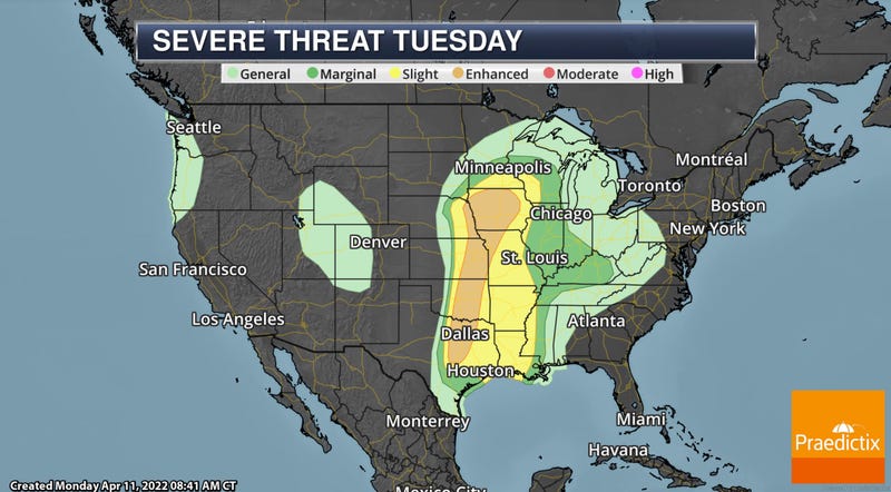
Tuesday Severe Storm Risk. SPC (NOAA's Storm Prediction Center) has southern Minnesota in a "slight risk" of severe storms tomorrow with an "enhanced risk" just to our south over Iowa. An approaching storm will tap southern moisture and deep instability to whip up a late-day squall line, capable of hail and damaging winds, mainly south of the Twin Cities metro area. The first watches and warnings of a chilly spring season are possible by late tomorrow.

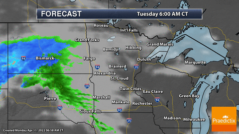
Timing the Storms. NOAA NDFD "Future Radar" shows a squall line of intense to severe thunderstorms bubbling up over Iowa by the dinner hour Tuesday, and then pushing (rapidly) northeast into Minnesota Tuesday evening. Again, the greatest potential for severe weather appears to be south and east of the Twin Cities.
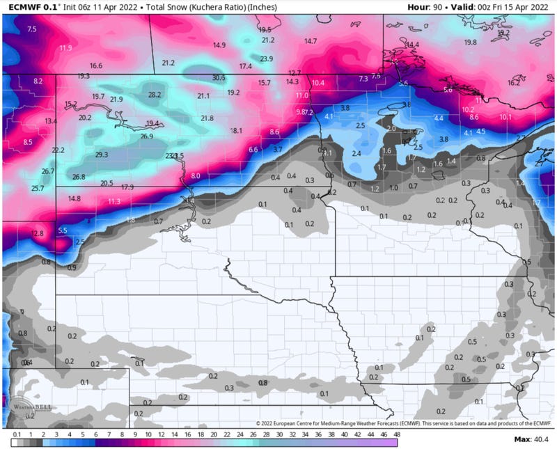
Serious Snow Potential. ECMWF (European) weather model guidance continues to print out a major blizzard for much of North Dakota from Tuesday through Thursday, with some 20"+ amounts predicted, along with extensive blowing and drifting. It's February all over again. A few inches may fall over far northern Minnesota and the Red River Valley, but it appears that North Dakota will get the worst of it.
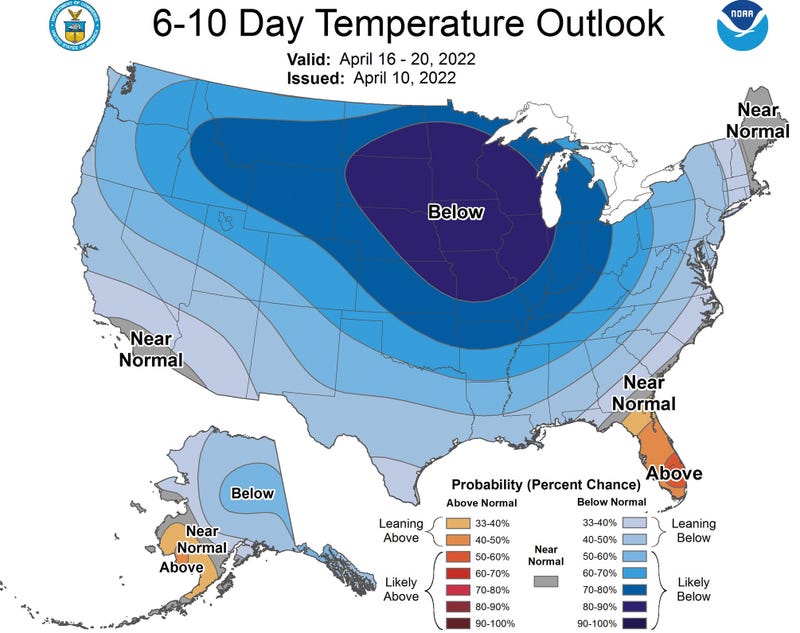
What April? For what it's worth I'm just as disgusted by our on-again, off-again spring as everyone else. And guidance from NOAA's Climate Prediction Center keeps us colder than average into next week, followed by a grudging warming trend later in April. The persistence of this cold bias is maddeningly impressive. I'm blaming La Nina, a lingering stain of cold water in the Pacific that has apparently hijacked the jet stream.
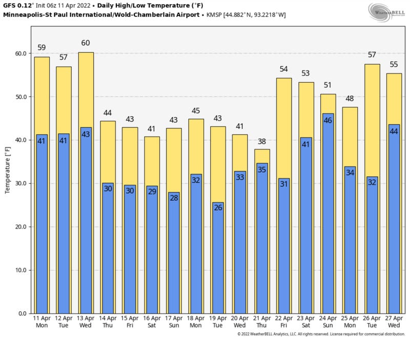
Late April: "Springish". I'm ready for a surge of 60s and 70s, but apparently the atmosphere is not. NOAA GFS guidance brings 50s back into town the last week of April, which seems too little too late. PS: I'm just the messenger.
If anyone asks (I sure hope they don't) MSP is on track for average snowfall for the winter season. Just shy of 50" of snow has fallen since last autumn, which is right where we should be by April 11. Ample moisture has eased our drought, and at some point a higher sun angle will bust through these nagging Canadian cold fronts and in a few weeks I hope to be complaining about bugs, humidity and thunderstorms.
Those days are coming. Keep the faith and brush up on your cold spring coping skills.
Related
