
There’s a winter storm warning in effect right now until 6:00 p.m. Tuesday evening it changes over to a winter weather advisory. Happy New Year.
WCCO Chief Meteorologist Paul Douglas takes a look at what to expect over the next two days, and what lies ahead for the rest of the week.
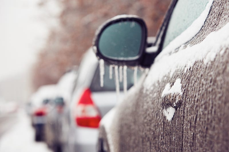
Could be an Icy Commute Home
A lot of people are might be planning their day and saying it might be a good day to work from home. It's going to be really bad driving home. Douglas agrees.
“It's coming in pretty fast," Douglas told Vineeta Sawkar on the WCCO Morning News. "Doppler radar is aglow with all kinds of new colors just south of the metro and all that moisture is surging northward. So I think it's going to be by 10:00, 11:00 this morning, reaching the metro as a mix of snow, sleet, of course that's ice pellets, and then freezing rain which is insidious.”
You might look out your window and think it’s just raining, but Douglas says that is deceiving.
“The problem is it's in the mid-twenties right now," says Douglas. "So any rain that falls will almost immediately freeze into a glaze. That's already happening over parts of far southern Minnesota. The worst of the ice storm, I think will be Mankato, Albert Lea and Austin where there could be a third of an inch of glaze on power lines, bridge overpasses and secondary roads.”
That means the roads are going to get worse in the Twin Cities as the day goes on says Douglas.
“The travel is going to go south, it's going to get worse as the day goes on.”
Metro Will See Varying Conditions by Location
There is a razor’s edge between snow, significant snow, mixed precipitation and rain with this storm. Where you are will determine what kind of storm you get.
“I do expect a mix, an icy mix in the metro, much better chance of icing south metro than north metro," Douglas predicts. "Once again, we’re kind of right on the edge, but I think certainly northern and western suburbs will see mostly snow.”
This is not a typical storm, and definitely not for January which normally sees a colder, drier snow. And "thunder snow" and potential lightening in January? Very bizarre.
“The storm prediction center, which issues the watches, tornado watches, they also issue special advisories for winter weather and they just issued an update for snow falling at the rate of one to two inches an hour," says Douglas. "Possibly even thunder snow. Could be some lightning out there as the surge comes in from the south.”
The Full Storm Outlook
Getting into work this morning was not a major problem. But driving home and then Wednesday could by far trickier.
“I think we will have three, four or five inches of icy slushy snow on the ground," Douglas said. "It's going to come down at a pretty good clip midday and afternoon (Tuesday). I think most of the metro will see about three to five, maybe six (inches) by this evening. And then this storm is going to stall out over Iowa tomorrow into Thursday morning and that will prolong this the storm. It should be all snow cold enough aloft for snow tonight and tomorrow. No ice and another three to five inches.
For storm totals, it will again depend on where you are and how much rain or freezing rain you get.
“I think when it's all said and done, by the time you fall out of bed Thursday morning, I still think it's going to be five to ten, six to ten, in that range," says Douglas. "More northern and western suburbs, less, more like five or six for Eagan and Lakeville and Woodberry but still plowable. Still a pretty good pile shaping up.”
And it will definitely be a heavier, wetter snow. Almost like a March snow.
“It's 24 degrees out there right now and I think it'll rise up into the upper twenties today," Douglas told Vineeta Sawkar. "But it's not going to be the light fluffy stuff that we had before Christmas that was blowing around and drifting and causing ground blizzards. Not that at all. There may be some minor drifting tomorrow into Wednesday night but this is not going to be a blizzard. It's more of an ice storm today from the south metro to the Iowa line. Immediate Twin Cities Metro, I still think it's going to be mostly snow, a little ice mixed in and then all snow tonight and tomorrow.”
This storm is followed by a mini cold snap, nothing too drastic, over the weekend. Then we warm back up again with temperatures approaching the 30 degree mark next week.
Tuesday: Icy mix, then snow. High: 32
Tuesday Night: Wintry mix and some light snow accumulations. Low: 28
Wednesday: More snow, totals from 6-10 inches in the Twin Cities. More to the west, with icy conditions south. High: 30
Thursday: Snow ends, low 27, high: 29
Friday: Some sun and colder, low 8, high 18
Related
