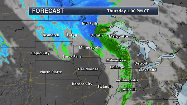

After a long, luxurious autumn, Old Man Winter is dishing up a friendly (?) reminder that the sun is as high in the sky as it was around February 1. As predictable as gravity, long nights over northern latitudes are brewing up cold air, and a surge of December-like air is spinning up a significant storm. Ironically, the best chance of accumulating snow in the Twin Cities will probably come Saturday night, when temperatures will be cold enough for all-snow, and a clipper may squeeze out a couple inches on our heads by Sunday morning. Here we go!
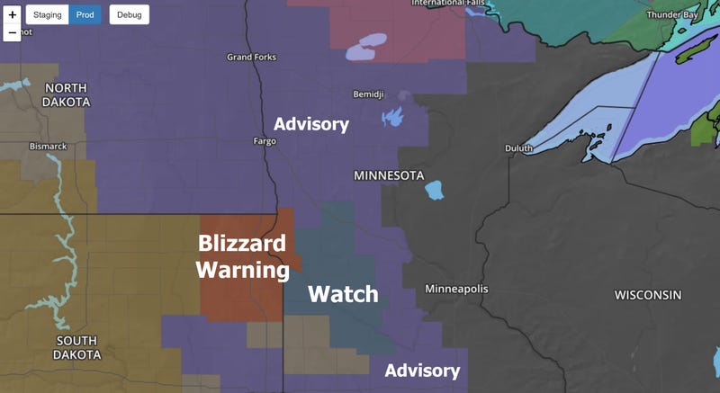
Winter Storm Watches: There are watches posted for much of southwest Minnesota with Blizzard Warnings in effect for parts of far west central Minnesota for low visibility caused by winds over 40 mph at times. Travel will be very rough over far western and northern Minnesota, but temperatures may stay (just) warm enough for a rain-snow mix in the metro and much of southern Minnesota into Friday night.
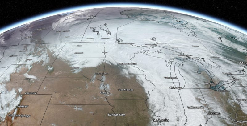
This is a sprawling storm, as you can see from a late morning visible satellite image. In this case moisture is wrapping entirely the storm, with snow approaching from the north and northwest, a meteorological phenomena known as "backlash". Ground temperatures are still relatively mild so there will be some initial melting, but as temperatures continue to fall that snow will start to stick.
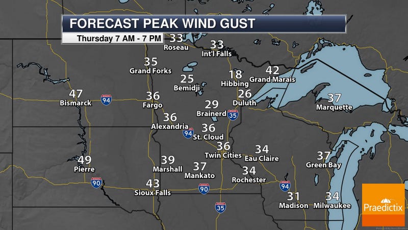
One of the big stories with this storm is the wind, gusting over 40-50 mph at times over far western and southwestern Minnesota, creating the possibility of blizzard conditions and treacherous driving conditions. The farther north and west you drive away from the Twin Cities the worse highway conditions will be.
The National Weather Service in the Twin Cities is predicting very rough travel conditions over far western and northern Minnesota, with fewer impacts in the immediate metro area, where winds will be lighter with temperatures mild enough for a little rain to mix in with the snow into Friday.
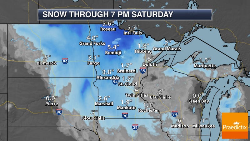
I suspect a coating of slush on some lawns in the metro area by Saturday evening, with a better chance of snowmobiling and cross country skiing opportunities farther north and west across the state. Potentially plowable over roughly the northwestern half of Minnesota.
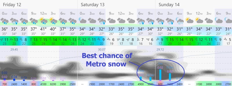
By Saturday night temperatures are cold enough for all-snow in the Twin Cities metro area, and an approaching Alberta Clipper may drop a couple of inches Saturday night into early Sunday, so plan on slippery roads in the MSP metro area into Sunday morning.
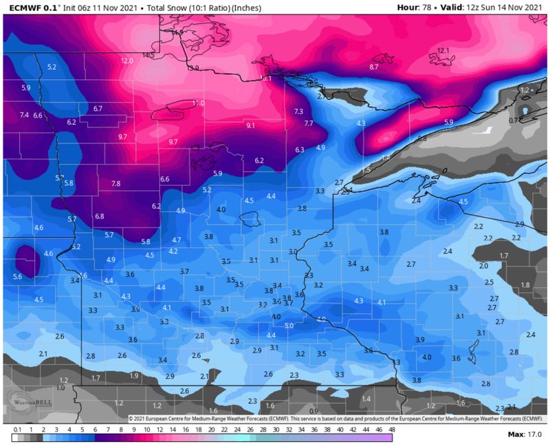
By Sunday morning a couple of inches of new snow may be on the ground in the metro area, with considerably more over northern and parts of western Minnesota. If anyone asks (doubtful) we normally get our first 1" snowfall by November 21 in the Twin Cities, so this is roughly a week ahead of schedule.
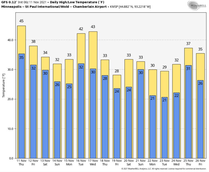
NOAA GFS Temperature Prediction: There will be some melting next week, but after being pampered with 60s in recent days a reality-readjustment is definitely on the way. Winter has been delayed, not cancelled. Enjoy (or tolerate) the snow! Be careful out there, and wait for all those leaves to blow into your neighbors yard.

Related
