
It might start to look a lot like Christmas over Thanksgiving week in the central and eastern U.S., with a potential cold front and storms predicted by the National Weather Service.
“Potential continues for a strong cold front and significant storm to affect the East early next week,” said the service Wednesday. This weather pattern is expected to evolve through the weekend through the middle of next week.
On the East Coast, temperatures are expected to be colder than normal.
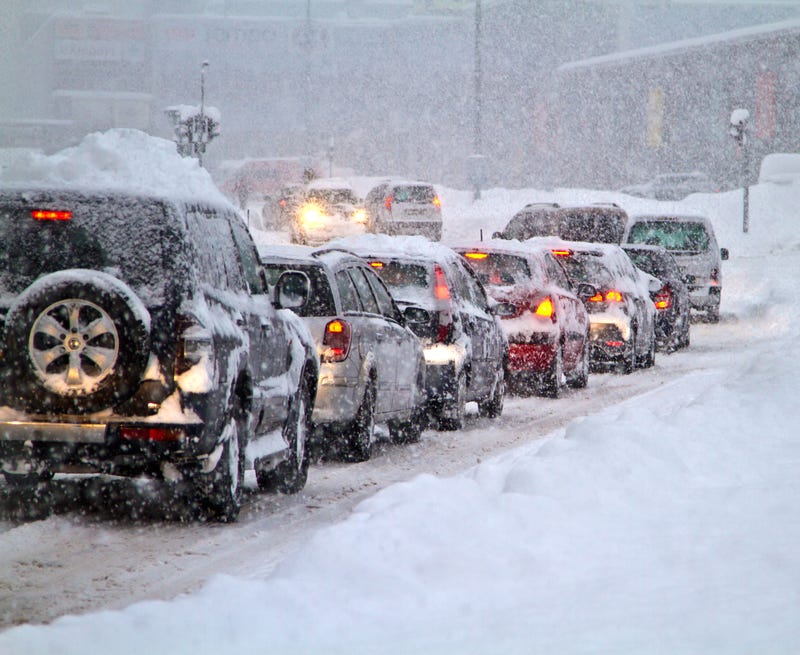
According to forecasters from AccuWeather, travel delays and disruptions may come along with these weather systems. An estimated 53.4 million people are expected to travel for the holiday this year, up 13 percent compared to last year, said AAA. At that time, there were no vaccines or treatments for COVID-19 vaccines and public health experts recommended keeping gatherings small.
Related

“We could be looking at a huge mess and a real wrench in holiday travel,” AccuWeather Chief Meteorologist Jon Porter said.
“There is still enough uncertainty in system evolution to allow for other possibilities regarding precipitation types and amounts,” said the National Weather Service.
However, it is likely that there will be a period of “brisk, strong winds behind the cold front sweeping through the Plains into the East,” and continuing over the Great Lakes and Northeast into Tuesday.
According to AccuWeather, the first of two possible storms “will organize over the central Plains Sunday and then track northeastward toward the Great Lakes Monday, and into central Ontario or western Quebec Tuesday.”
This storm could strengthen rapidly enough to be classified as a “bomb cyclone” with central pressure of plummeting to 0.71-inch of mercury within 24 hours.
An area of heavy snow may spread across portions of Minnesota, northern Wisconsin, northern Michigan, and central portions of Ontario and Quebec due to this storm. As it pushes into Canada, high winds could develop when temperatures are expected to drop across the Midwest and then the Northeast.
Accumulations of snow could also hit northern Indiana and Michigan as well as parts of Ohio, West Virginia, Pennsylvania, Maryland, and New York state from Monday to Wednesday. Though the storm is potentially centered in the Midwest, the cold front is expected to sweep across the Southern states, Appalachians and Eastern Seaboard Monday into Tuesday, bringing rain and thunderstorms.
Heavy precipitation could lead to flooding and disrupt travel for motorists through the I-95 corridor.
AccuWeather forecasters are also monitoring a second storm near the Atlantic coast beginning on Monday. This storm could also develop into a bomb cyclone and bring snow along with it.
“There is a chance that several inches to a foot or more of snow will fall on areas from northeastern New York state, near and north of Albany, New York, to Vermont and northwestern New Hampshire in this rapidly strengthening secondary storm scenario,” said AccuWeather meteorologist Bernie Rayno.
Other areas on the East Coast may get heavy rain.
Apart from impacting roads, severe weather could make travel difficult at airports.
“A major storm may significantly compound airport and airline operational challenges that have plagued the air travel industry of late,” Porter said.
Winds alone can lead to delays at airport hubs.
To avoid nasty weather systems and travel catastrophes reminiscent of the 1987 Jon Hughes Thanksgiving classic “Planes, Trains & Automobiles” people with flexible travel plans may want to start their trip on Friday, ahead of the weekend, said AccuWeather.
Related

Related
