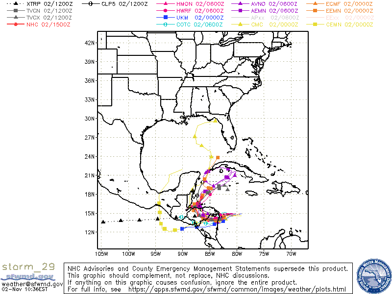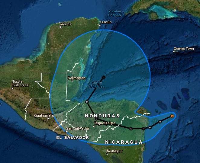

The National Hurricane Center now forecasts that Hurricane Eta will make landfall over Nicaragua tomorrow as a major hurricane, move into Honduras by Thursday and then get back out over the Caribbean Sea.
Once there, forecasters say it could redevelop into at least a tropical storm.
"Most of the global models depict a cyclone over the northwestern Caribbean Sea later this week and into the weekend which appears to develop from at least a part of Eta's remnants, and the new NHC track forecast shows the system emerging over the northwest Caribbean Sea," Senior Hurricane Specialist Daniel Brown said.
Related

Models then show it going anywhere from Cuba to the US Gulf Coast.
"The uncertainty in the long-range portion of the forecast remains quite high," Brown stresses.
It could get a new name, Theta, if that happens. It depends if it still has a center of circulation as Eta. If not, it would be Theta if it were to redevelop.
Louisiana has never been hit by a named storm in November. One model showed a path toward Louisiana yesterday, it now calls for a track to the Florida Panhandle next week.
Eta is expected to bring 140 mile per hour winds to Central America and more than two feet of flooding rain and mud slides to Nicaragua, Honduras, Guatemala, Belize, Panama and Costa Rica.
Eta is the 28th named storm of the 2020 Hurricane Season. That is the furthest into the Greek alphabet we have ever gone for storm names and ties the record number of storms set during the 2005 season.