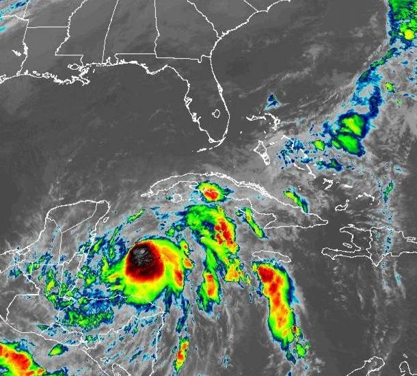

Zeta is still a tropical strom in the Caribbean and forecast to move into the Gulf of Mexico tomorrow as a hurricane.
"Maximum sustained winds are near 70 mph with higher gusts. Strengthening is forecast, and Zeta is expected to become a hurricane later today."
The national Hurricane Center says the track calls for Zeta to move over Mexico before taking a path toward somewhere between Southeast Louisiana and the Florida Panhandle.
"On the forecast track, the center of Zeta will move near or over the northern Yucatan Peninsula later today or tonight, move over the southern Gulf of Mexico on Tuesday, and approach the northern Gulf Coast on Wednesday."
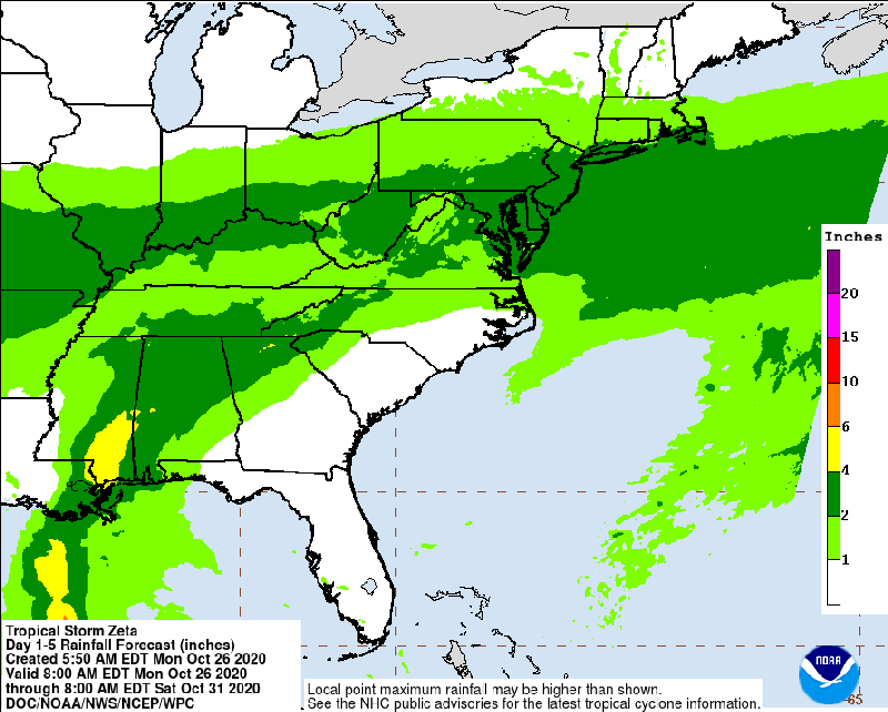
Forecasters say Zeta could bring hurricane force winds, storm surge and heavy rain from Louisiana to Florida.
WWL TV Meteorologist Dave Nussbaum says combination of factors could still change the forecast path and intensity. Those include Zeta's interaction with land, the cooler Gulf waters, dry air from the cold front this past weekend and another cold front heading down from the north.