
We can stop worrying about wrapping pipes and frozen conditions for the rest of this year.
"It's the last week of 2022! We'll begin to transition back to a warmer than normal pattern by Wednesday," WWL TV Meteorologist Payton Malone forecast. "Luckily after this morning the area will be done with pipe-bursting freezes."
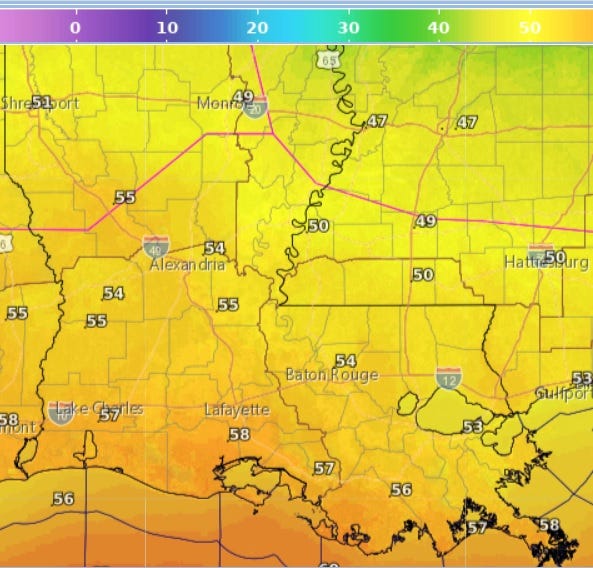
He says we can expect 50s for highs today and tomorrow, with Wednesday temperatures back near 70 degrees.
"With warmer weather on the way along with higher humidity, we'll probably start to see fog by the middle of the week. Toward Friday and Saturday a storm system will bring rain and storms to the area, but temperatures look to stay in the 70s through the weekend as we bring in 2023."
Malone does not expect New Year's Eve to be a washout, but says there will be some rain around.
Detailed Forecast...
TODAY:
Chilly and mostly sunny to partly cloudy. High: 55.
TUESDAY:
Mostly sunny. Chilly morning, no freezes. Cool afternoon. Low: S 42, N 32. High: 58.
WEDNESDAY:
Mostly sunny. Cool morning, but warmer afternoon. Low: S 45, N 38. High: 71
THURSDAY:
Mostly sunny. Cool morning, but warmer afternoon. Low: S 45, N 38. High: 74.
FRIDAY:
Mostly cloudy. Higher humidity, areas of fog possible. 50% chance for rain. Low: S 61 N 57 High: 73
SATURDAY:
Areas of rain around. Low: S 62 N: 60. High: 73
SUNDAY:
Spotty showers. Low: S 62 N: 60. High: 72