
Hurricane Ida is now forecast to have sustained winds of 140 miles per hour in the Gulf of Mexico, making it an "extremely dangerous major hurricane."
It is now expected to be a category four hurricane before hitting Louisiana.
Ida's maximum sustained winds increased to near 80 mph according to the latest advisory from the National Hurricane Center.
"Steady to rapid strengthening is expected when Ida moves over the southeastern and central Gulf of Mexico over the weekend," according to the Hurricane Center.
Landfall is now forecast in Terrebonne Parish late Sunday with a path toward Houma, and then the eye moving over the Baton Rouge area.
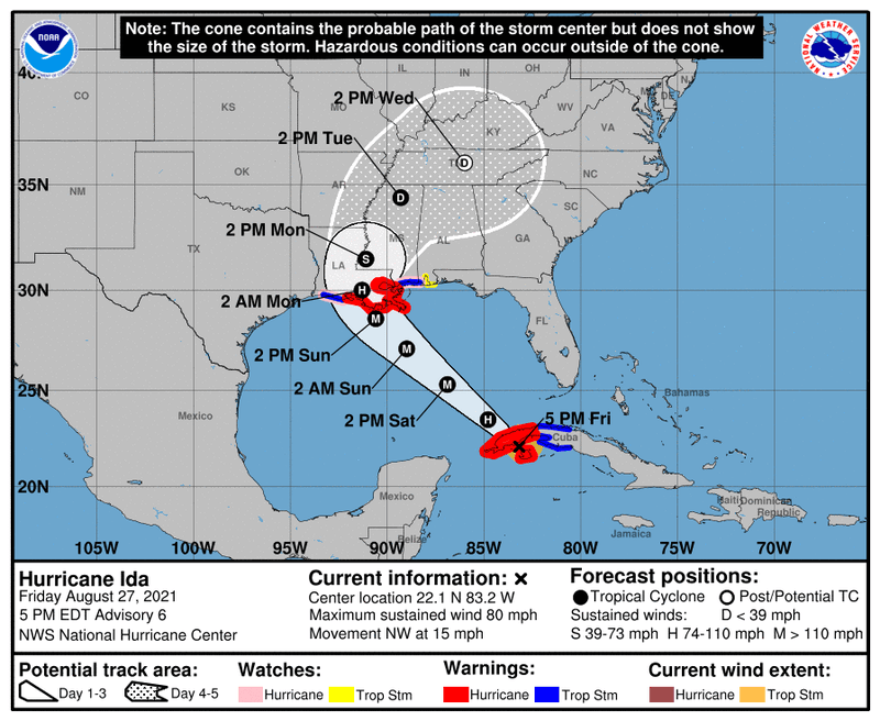
A Hurricane Warning has been issued for the coast of Louisiana from Intracoastal City to the Mouth of the Pearl River, including Lake Pontchartrain, Lake Maurepas, and Metropolitan New Orleans.
The Hurricane Center says with a category four...
Catastrophic damage will occur: Well-built framed homes can sustain severe damage with loss of most of the roof structure and/or some exterior walls. Most trees will be snapped or uprooted and power poles downed. Fallen trees and power poles will isolate residential areas. Power outages will last weeks to possibly months. Most of the area will be uninhabitable for weeks or months.
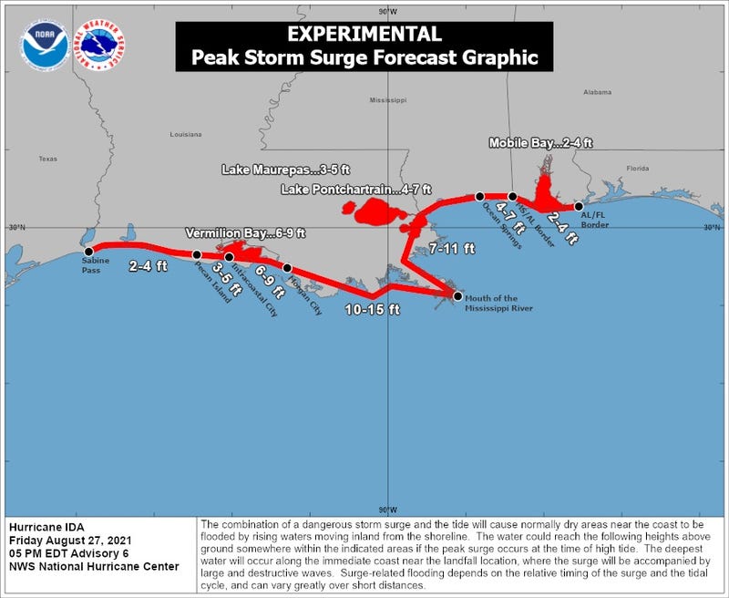
A Storm Surge Warning has been issued from east of Rockefeller Wildlife Refuge, Louisiana, to the Mississippi/Alabama border including Vermilion Bay, Lake Borgne, Lake Pontchartrain, and Lake Maurepas.