


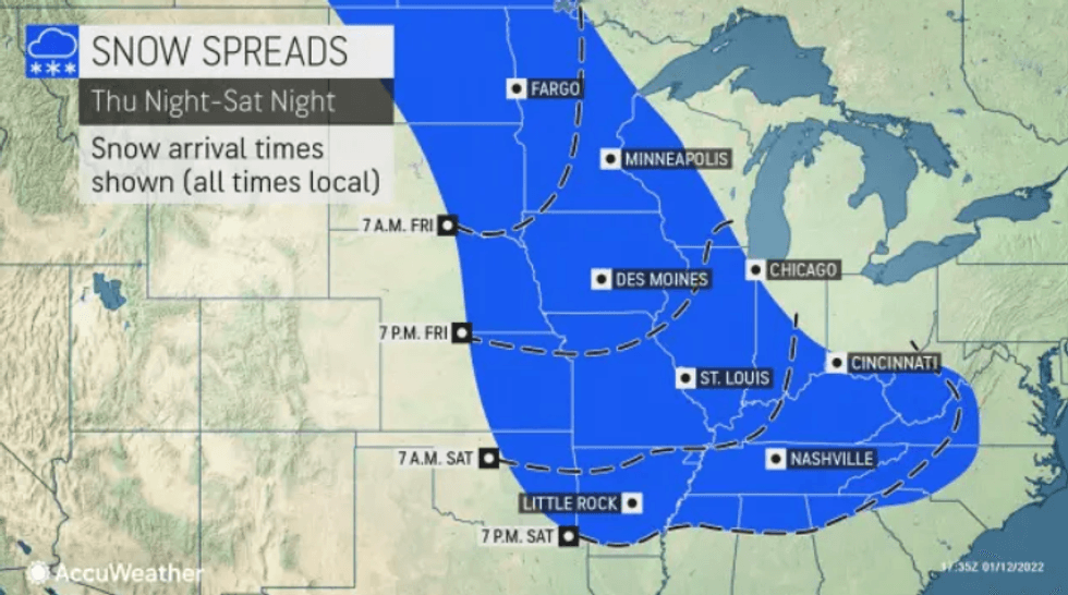
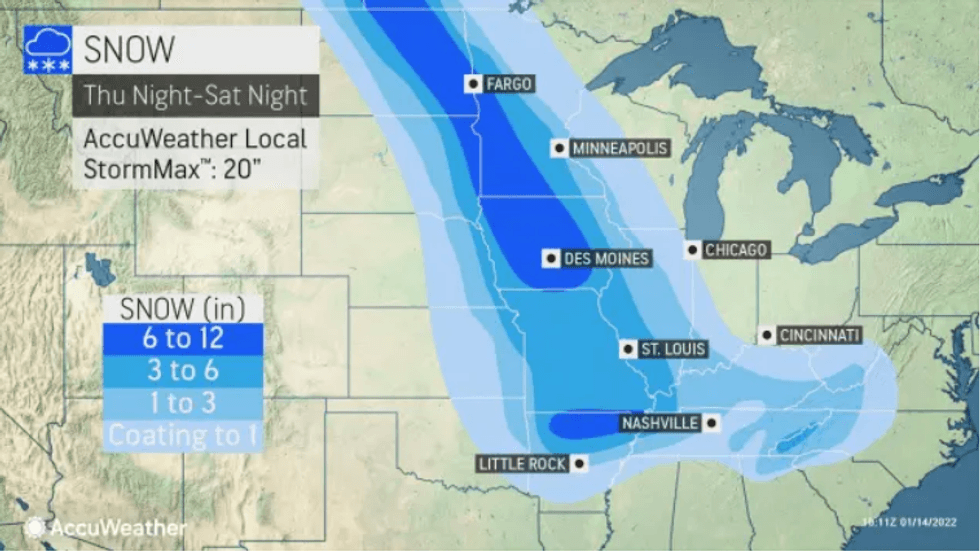
ST. LOUIS (KMOX) - A new wave of arctic air is heading towards St. Louis Thursday that will last through this weekend. The forecast is calling for between 3-4 inches of snow, with some spots up to 6 inches on Saturday morning in the area. That could change as better data comes in.
The snow system worth watching is for Friday night, with some wet snow that turns into all snow after midnight and into Saturday morning.
 (Courtesy of AccuWeather)
The storm will take the shape of a modified clipper type system, which some meteorologist call a "Saskatchewan screamer." These types of storms originate in western Canada, bringing up to 12 inches of snow in some parts of the Midwest, according to AccuWeather.com.
 (Courtesy of AccuWeather)
The National Weather Service has issued a Winter Storm Weather Watch for northeast Missouri and west-central Illinois where the heaviest snow is expected to fall.
Our AccuWeather meteorologist DeVore says the St. Louis area is looking at between 3-6 inches of accumulation, but that could change over the next few days depending on the storm's track.
If it holds true, it would be the first measurable snowfall of the year, after a dusting in the area on Jan. 2. But before the snow, we have some warmer days on Wednesday and Thursday with highs in the 50s and 40s, respectively.

© 2021 KMOX (Audacy). All rights reserved
LISTEN on the Audacy App
Follow KMOX
Facebook | Twitter | Instagram