


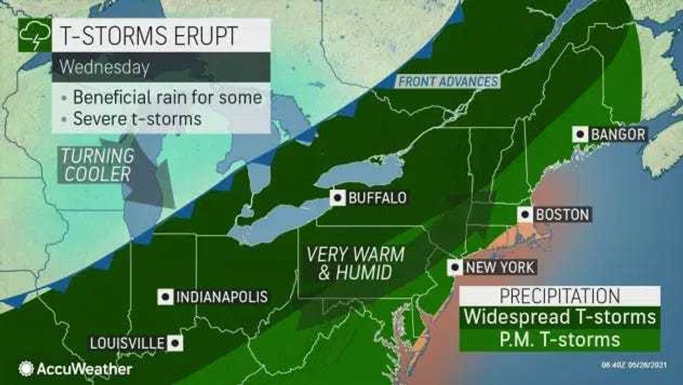
NEW YORK (1010 WINS) – Severe thunderstorm warnings are in effect for the New York City area ahead of stormy weather that has the potential to bring damaging winds, hail, and downpours.
The watch was issued for all five boroughs and Westchester, Rockland, Orange and Putnam counties until 10 p.m. on Wednesday.
Clouds will build before scattered thunderstorms in the evening, according to AccuWeather.
The storms may produce damaging winds, hail, flooding and downpours. The storms will likely move through between 5 p.m. and 11 p.m.
 AccuWeather
The Department of Buildings advised property owners, contractors and crane operators to take precautionary measures ahead of the high winds.
Wind gusts could top 55 mph, the department warned.
Gov. Andrew Cuomo directed state agencies to prepare emergency response assets for the storms, which could lead to power outages and downed tree limbs.
"A strong cold front on Wednesday is forecast to produce several thunderstorms and strong winds up to 60 mph in several areas across our state, as well as the potential for hail and lightning," Cuomo said in a statement. "State agencies are watching the conditions and are ready to assist local partners as needed. I urge everyone to keep a close eye on the weather and be ready to take shelter and alter any prescheduled plans accordingly, including travel and outdoor activities."
 AccuWeather
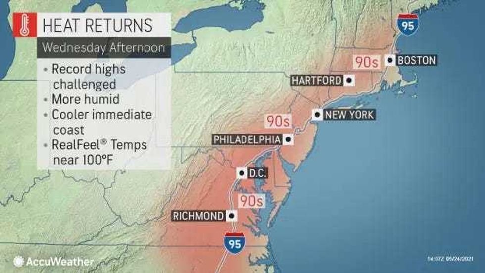
The stormy weather comes as highs are expected to approach 90 degrees in the city and inland suburbs. It should remain in the 70s at beaches.
It stays sticky with a shower around overnight Wednesday. The low will be near 70.
It's sunny, breezy and not as warm with lowering humidity on Thursday as highs reach the low 80s.
Friday is breezy and much cooler with increasing clouds. Rain arrives in the afternoon and continues into Friday night. The high will be 67.
It will remain cool for Memorial Day weekend, with highs in the 60s on Saturday and Sunday and in the mid-70s on Monday.