DETROIT (WWJ) - Metro Detroiters are in for another difficult morning commute as heavy fog and icy roads create travel hazards for much of Southeast Michigan on Wednesday.
A Dense Fog Advisory is in effect for St. Clair, Livingston, Oakland, Macomb, Washtenaw, Wayne, Lenawee and Monroe counties until 11 a.m. with most areas dropping to reduced visibility of one quarter mile or less due to heavy fog.
The fog is affecting residents in cities from Port Huron, Howell and Pontiac, out to Ann Arbor, Detroit and down to Adrian and Monroe.
The National Weather Service office in Detroit said the weather is creating hazardous driving conditions due to low visibility with areas of dense fog expected to develop and persist across the region into Wednesday night.
Fog isn't the only problem drivers are running into. Localized icy spots are also coating cold road surfaces that were left untreated overnight.
WWJ's Cassandra Llamas reported 11 Mile Road in Farmington Hills, between Drake and Halstead, was a sheet of ice just before 6 a.m. while residents out in Novi and Northville said parking lots and front porches were also slick.
WWJ traffic reporter Jim Hughes said black ice was reported on dirt roads in northern Oakland County, in the city of Oxford.
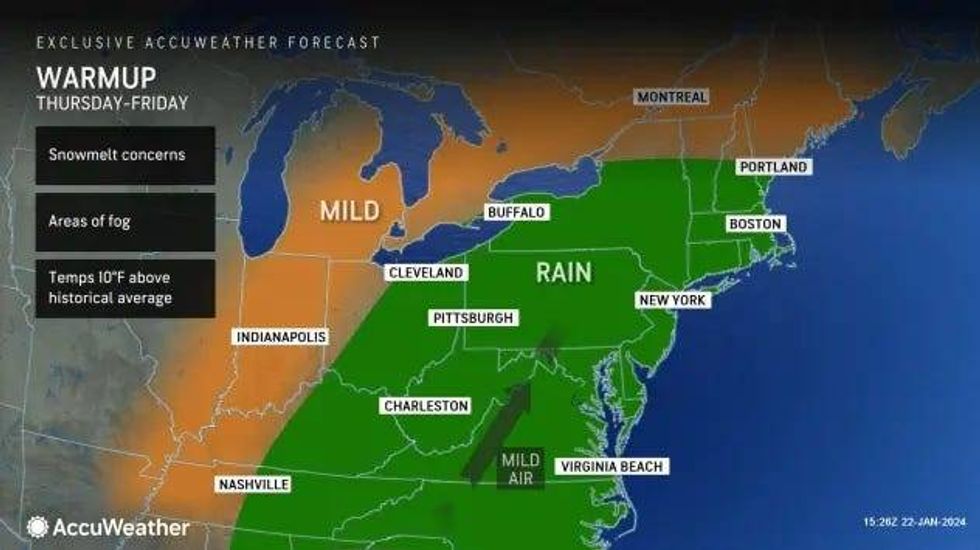
AccuWeather meteorologist Dean DeVore said temperatures are on the "slow rise" here as the day continues with drizzle and the fog in the late morning hours before transitioning to a steady rain that will persist into the afternoon.
"Icy conditions with the cold ground early, but then temperatures slowly rise through the 30s this afternoon, I think mid-upper 30s with some steady rain tapering the drizzle," DeVore said. "Tonight, we're looking at foggy conditions returning temperatures. Then tomorrow will get up in the low 40s after some drizzle and fog in the morning, more steady rain in the afternoon and evening."
The unseasonable warming trend is expected to affect least 200 million people with Michigan about to experience a "weather whiplash" from the -19 wind chills recorded in areas across Metro Detroit last week.
 AccuWeather
"The warmup will be dramatic, making it feel like a completely different season," AccuWeather Senior Meteorologist Courtney Travis said.
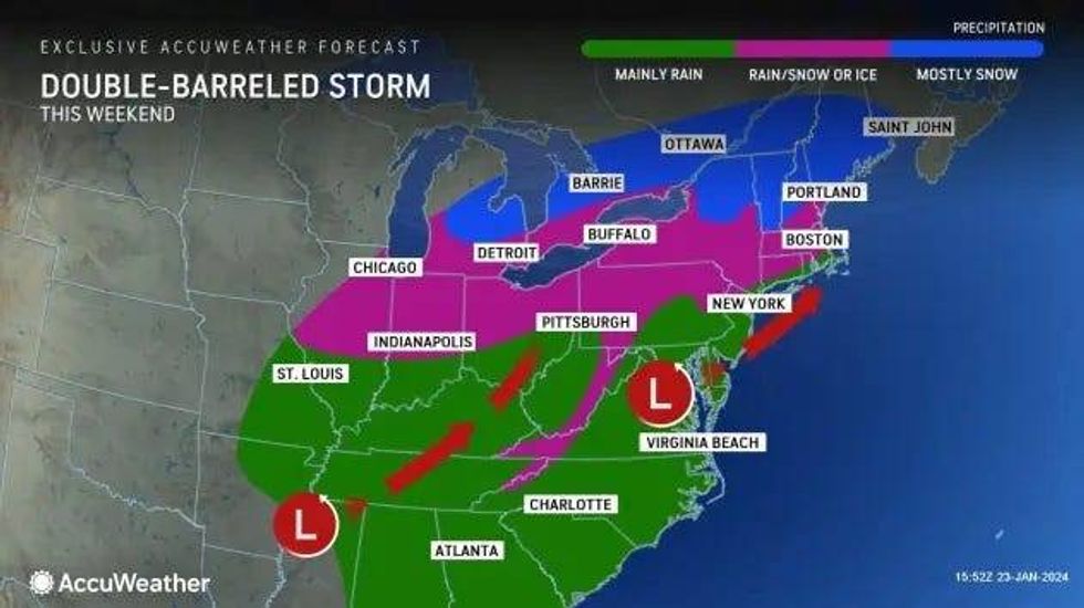
We will dry out Thursday into Friday with temperatures up to about 40 to 45F, Devore said, but another weekend storm looks like it is taking aim at Metro Detroit on Saturday night into Sunday.
AccuWeather said the weekend storm may encounter fresh cold air as it moves through parts of the Midwest, bringing snow to the Thumb region and the threat of freezing rain, sleet and ice once again to Metro Detroit.
Stay tuned to WWJ LIVE for the latest forecast with Traffic and Weather on the :08s.
 AccuWeather