The peak of the Atlantic Hurricane Season is September 10th, and right on schedule, things are heating up.
In addition to Hurricane Dorian, there are three areas of possible development over water now, and another one expected to blow off the coast of Africa.
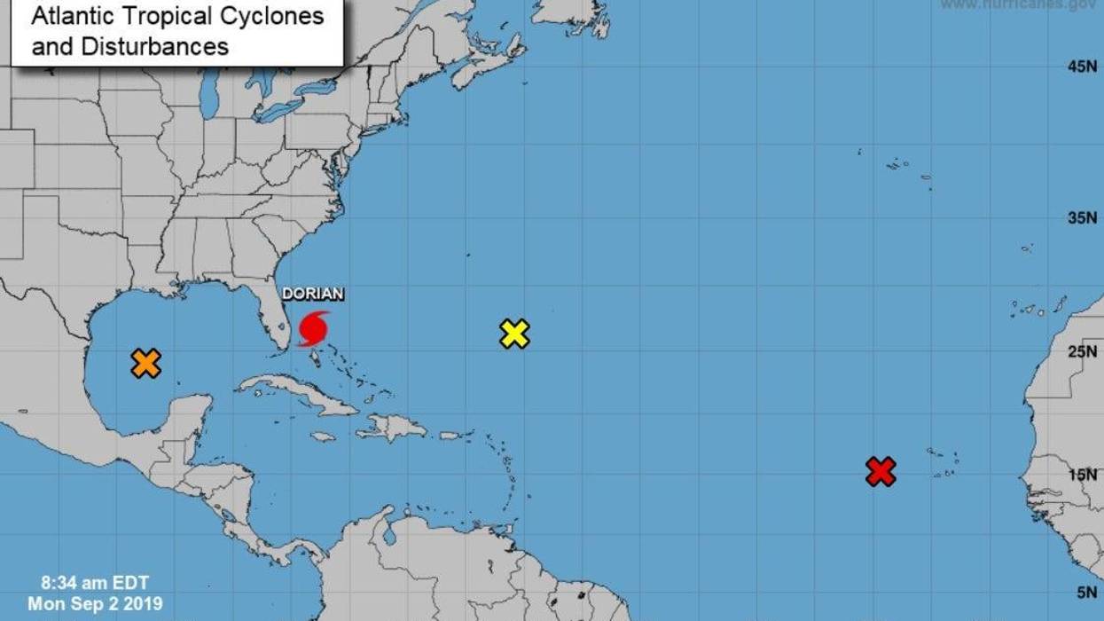
The one closest to Louisiana, is no threat to our area... but could bring some passing showers today as it passes to our south.
"A broad area of low pressure located over the south-central Gulf of Mexico is producing a wide area of showers and thunderstorms," according to the National Hurricane Center.
That system appears headed for Mexico with a 40 - 50% development chance.
"Shower and thunderstorm activity associated with a low pressure system located about 300 miles west of the Cabo Verde Islands continues to show signs of organization"
Federal forecasters says a tropical depression is expected to form during the next day or so while the system moves generally northwestward across the eastern tropical Atlantic Ocean.
Meanwhile another trough of low pressure is located several hundred miles south-southeast of Bermuda.
"Although the associated showers and thunderstorms continue to show signs of organization, the system does not have a well-defined surface center. Gradual development of this system is possible during the next few days while the disturbance moves slowly northward or north-northwestward."
The Hurricane Center says interests in Bermuda should monitor the progress of this disturbance, which has a 30% shot at development in the next two days and 50% over the next five days.
Another tropical wave is forecast to emerge over the far eastern tropical Atlantic between Africa and the Cabo Verde Islands in a few days.
"Some gradual development of this disturbance will be possible late this week or over the weekend while it moves westward to west-northwestward."