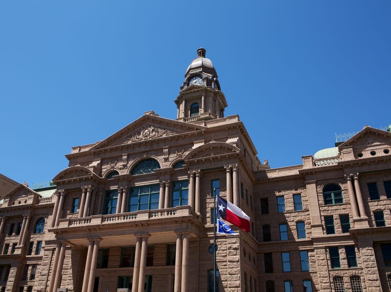

The Fort Worth City Council is in the final stages of redrawing its council district map, as it's required to do every 10 years.
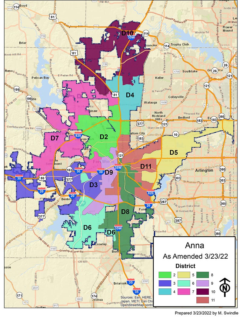
What's unique this year is thanks to city voters, the number of districts will increase from eight to 10. They'll be numbered two through 11, with District 1 essentially being the mayor.
The council finalized the map during a marathon work session on Wednesday.
One of the big sticking points was the makeup of one of the new districts -- District 11 in the southeastern portion of the city.
Some people wanted to include the Poly neighborhood, which includes Texas Wesleyan University, in that new district, while others wanted to keep it in District 8, which is represented by Chris Nettles.
"Our hope was to create an additional strong Hispanic opportunity district," Fort Worth Mayor Mattie Parker said.
In the end, the Poly neighborhood remained in District 8, creating somewhat of a "horseshoe" design that lumps West Morningside in with the Meadowbrook and United Riverside neighborhoods.
"The compromise was to create a horseshoe feature that minimized a splitting of neighborhoods as much as possible," Parker said.
Among other rules, all districts must have roughly equal populations, must have contiguous borders and cannot be racially discriminatory.
Another district of note is District 6, which essentially creates an island in the Como neighborhood and lumps it with Hulen Bend and Mira Vista, south of I-20, using the easement along Bryant Irvin Road as the connector.
"The Como community came to the city council, asking to be placed in Council District 6," Parker said. "They articulated the reasons for doing so in a very united voice."
LISTEN TO 1080 KRLD FOR LATEST NEWS, WEATHER & TRAFFIC.
The other new district, District 10, is in the extreme northern part of the city. It essentially encompasses the U.S. 287 corridor to the west, extending north to State Highway 114, including Texas Motor Speedway, east to U.S. 377 and south to Golden Triangle Boulevard.
Districts 10 and 11 were numbered as such, since no current council members live within their boundaries.
Also, no two current council members live in the same district as redrawn, meaning none of the current members will be forced to run against one another in next year's municipal election.
The council will vote to formally adopt the map at its next regular meeting Tuesday at 10 a.m.
"I'm not saying it's perfect by any means, and there are probably several people that wish it was different," Parker said. "But I think all together, we created what is best for the future of Fort Worth, at least for the next 10 years."
Related

LISTEN on the Audacy App
Sign Up and Follow NewsRadio 1080 KRLD