
It's time to take a break from the severe weather. How does that sound? This being said, there will be some isolated storms around over the holiday weekend, but the severe threat looks low for now.
It's not a bad morning as temperatures have fallen into the mid forties to low fifties. A beautiful day is on the way, with low humidity and highs in the upper seventies. Warming up into Good Friday with readings in the mid eighties, it will be a little breezy though.
A cold front will flirt with us this holiday weekend. There could be a few isolated showers and storms along the front, but right now I'm not looking for anything widespread or severe. Afternoon highs will range from 75 north to 85 south of DFW.
By Monday, this front will get the kick it needs to head well to the south of the area. Drier air will filter in with highs and the mid seventies.
Tuesday and Wednesday we'll be close to 80゚, with the chance for showers and storms by late Wednesday evening.
*Yest Rain: 0.01”; *Yest High: 82; Low: 56
*Today’s Averages: High: 76; Low: 55
*Record high: 91 (1951); Record low: 35 (1959, 1997)
* April rain: 1.59”; April surplus: + 0.32”
*2022 Rain: 5.82”; 2022 deficit: 4.04"
*Sunrise: 7:00am; Sunset: 7:58pm
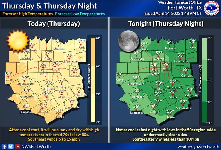
Today: Sunny and seasonable. High: Upper 70s. Wind: SE 10-20 mph
Tonight: Clear and quiet. Low: Low to mid 50s. Wind: SE 10-20 mph.
Tomorrow: Sunny, breezy, and a bit warmer. High: Mid 80s. Wind: SSE 15-25, G30 mph.
Saturday: Partly cloudy and nice. Weak cold front slides through. Isolated late day showers and storms. High: Upper 70s.
Easter Sunday: Partly cloudy and pleasant. Slight chance for showers and storms. High: Near 80.
Monday: Partly cloudy, windy and cooler. High: Mid 70s.
Tuesday: Mostly sunny and perfect. High: Upper 70s.
Wednesday: Partly cloudy. Isolated showers and storms. High: Near 80.
Related

LISTEN on the Audacy App
Sign Up and Follow NewsRadio 1080 KRLD