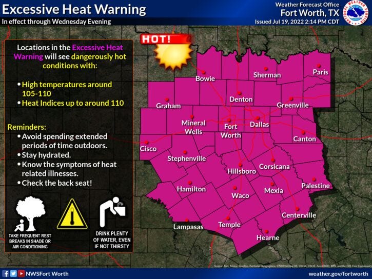

Weather changes are on the way, but we have one more day today of intense heat! An Excessive Heat Warning is in effect for all of north Texas through this evening.
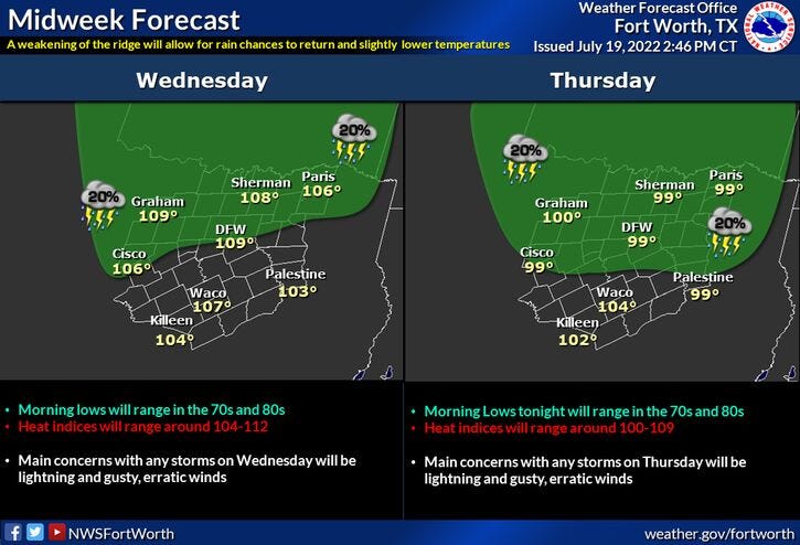
After record-breaking heat yesterday, we have one more day we'll be flirting with a record, with a high temperature near 108°. That would tie the record set back in 2018. There's also a very slight chance of some late afternoon and evening showers and storms along and north of I-30. A few could become strong to severe...with damaging wind, small hail and lightning being the threats.
It's not out of the question that a few leftover showers and storms will continue overnight tonight with low temperatures between 78° and 82°. Some areas may be a little bit cooler if you have some rain overnight.
Shower and thunderstorm chances continue into tomorrow as well. A 40% coverage!! Again, damaging wind, small hail, and lightning will be the threats. Hope you see some rain!
Temperatures will also be knocked down due to the clouds and rain in the area, with highs only in the mid-90s, but heat index values will be slightly above 100° due to an increase in humidity.
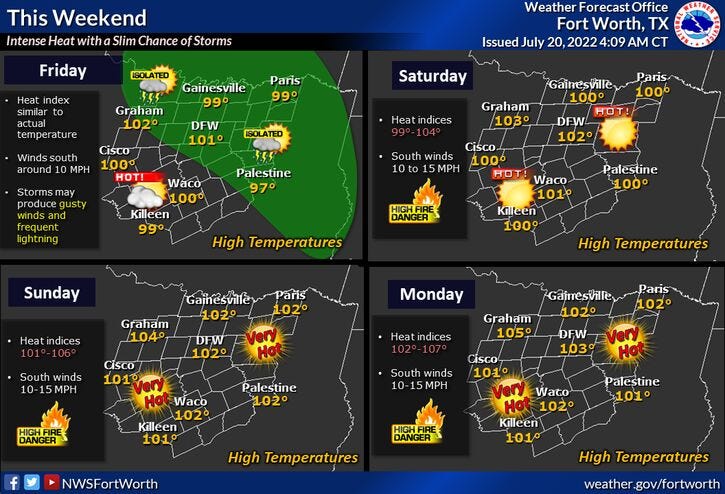
One last chance for some showers and storms on Friday, but coverage will not be as great. Daytime highs will hover near 100°. Heat index values 105 +.
As we head into the weekend and next week, the heat builds back across the area as triple digits return. 102° to 103° into the weekend, 103° to 104° through midweek! My sincere apologies.
Important: If you see a thunderstorm in the distance and you're out on the area lakes, you need to get off the water immediately! Same thing if you're in any local swimming pools or in your backyard. If you hear thunder, seek shelter!
*Yest Rain: 0.00”; *Yest High: 109R; Low: 84
*Today’s Averages: High: 96; Low: 76
*Record high: 108 (2018); Record low: 65 (1920, 2014)
*July rain: 0.00”; July deficit: 1.51"
*2022 Rain: 12.41”; 2021 deficit: 9.39"
*Sunrise: 6.34am; Sunset: 8:35pm
Today: *Excessive Heat Warning* Partly cloudy, breezy, and VERY hot. High: 108-110 (Record 108). Wind: SSW 10-20 mph.
Tonight: Slight chance of showers and storms. Low: 78-83. Wind: SSW 10-20 mph.
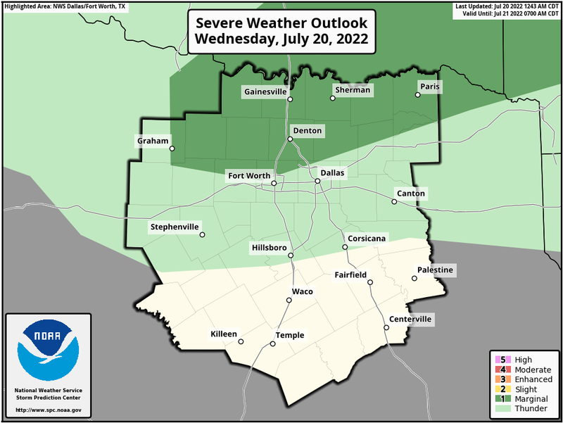
Tomorrow: Mostly cloudy, not as hot! 40% chance of showers & thunderstorms. Level 1 out of 5 for severe storms (DFW->north). Threats: Wind, lightning and small hail. High: Mid 90s. Wind: SSW 5-10 mph.
Friday: Partly cloudy, hot and humid. Isolated showers and gusty thunderstorms. High: Near 100.
Weekend: Sunny and hot. HIghs: 102-104.
Monday: More of the same. Sunny and hot. High: 104.
Tuesday: Sunny and hot. High: 105.
Related

LISTEN on the Audacy App
Sign Up and Follow NewsRadio 1080 KRLD