
Sorry about all the rough weather yesterday evening across North Texas.
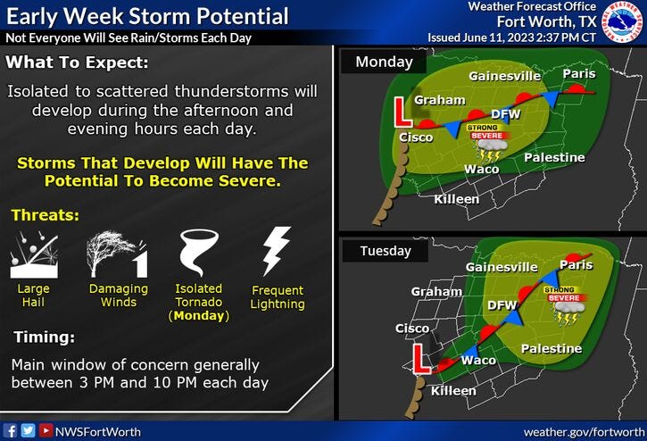
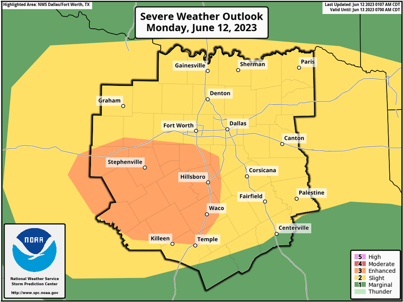
Unfortunately, we have another chance for severe storms late this afternoon and evening and then again tomorrow late afternoon and evening. Large hail and damaging wind are the threats.
After Tuesday, storm chances fade away and temperatures will be on the rise! As of now, it looks like our first triple digit heat arrives across north Texas by the end of the week and into the weekend.
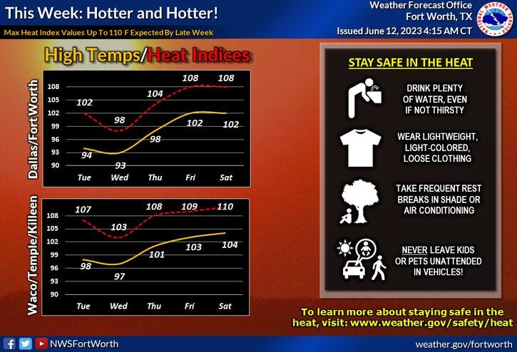
To make matters worse, heat advisories will most likely be issued for heat index values above 105゚. Surface temperatures will range between 99 and 103 degrees.
Please stay weather aware late this afternoon and evening and then again tomorrow afternoon and evening. I'll be keeping an eye on things as usual.
*Yest Rain: 0.08"; Yest High: 99; Low: 71
*Today’s Averages: High: 91; Low: 72
*Record high: 103 (1953): Record low: 57 (1910)
*June Rain: 0.08"; Deficit: 1.36"
*2023 Rain: 13.66"; Deficit: 4.37"
*Sunrise: 6:19am; Sunset: 8:37pm
Today: Morning showers and storms north and east, then partly cloudy, hot and humid. Severe risk returns late this afternoon and evening. Threats: Large hail and damaging wind. High: Low to mid 90s. Variable 10-15 mph.
Tonight: Scattered evening showers and storms, ending by midnight. Some possibly severe. Threats: Large hail and damaging wind. Low: 68- 72. Wind: SSE 10-15 mph.
Tomorrow: Partly cloudy, hot and humid. Scattered late afternoon and evening storms. Some severe. Threats: Large hail and damaging wind. High: Low to mid 90s. Wind: WSW 10 mph.
Wednesday: Partly cloudy, hot and humid. Isolated late afternoon and evening storms (less numerous). High: Low to mid 90s.
Thursday: Partly cloudy, hot and humid. High: Mid to upper 90s.
Friday - Sunday: Sunny, hot and humid. Possible Heat Advisories. Highs: 99-103. Heat indicies 105+.
Related

LISTEN on the Audacy App
Tell your Smart Speaker to “PLAY 1080 KRLD”
Sign Up and Follow NewsRadio 1080 KRLD