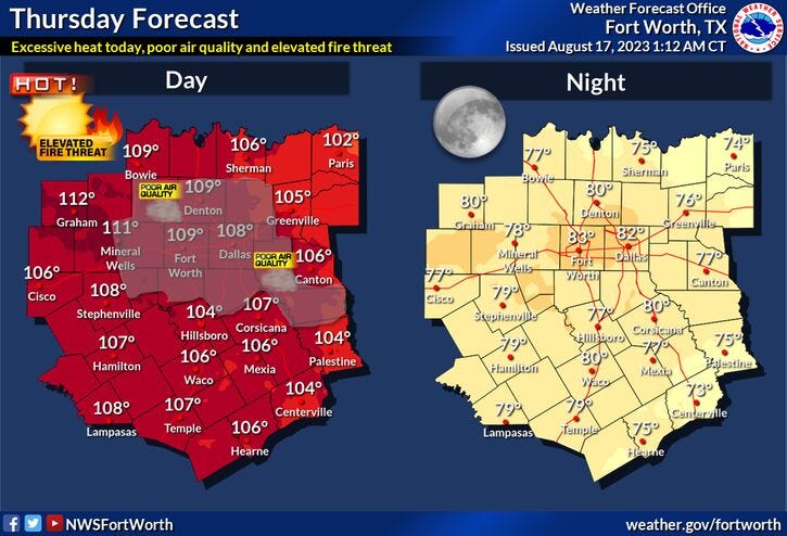

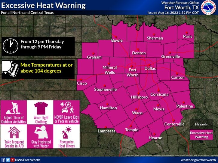
The Excessive Heat Warnings are back across North Texas through at least Friday, and these will most likely be extended into early next week.
This will be the strongest ridge of high pressure we have felt so far this summer. If we take any good news out of this, we are more than halfway through August, and fall is 37 days away.
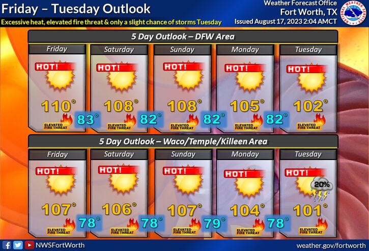
Record-breaking heat is possible five out of the next 7 days. Afternoon highs will range from 105 to 111° through the period, with the hottest days tomorrow and Sunday. Some areas will exceed 111° on Sunday. The highest temperature ever recorded in DFW was 113°, and that happened twice at the end of June back in 1980.
Weather change coming next week?
I'm keeping my fingers crossed for a possible pattern change by the middle of next week. That is, if something tropical forms in the Gulf of Mexico and heads into Texas. It's still way too early to tell if something will form and where its moisture will go. Will it head into central Texas bringing us clouds, rain and cooler temperatures, or will its moisture move into deep south Texas? Can't track a storm that hasn't formed yet.
*Yest Rain: 0.00"; Yest High: 97; Low: 71
*Today’s Averages: High: 96; Low: 76
*Record high: 107 (1951): Record low: 63 (1972)
*August rain: Trace; Deficit: 0.96
*2023 Rain: 14.83"; Deficit: 8.50
*Sunrise: 6:53am; Sunset: 8:11pm
Today: *Excessive Heat Warning; Air Quality Alert* Sunny and hot. Near record heat. High: 107 (Record is 107). Wind: SSE 5-10 mph.
Tonight: Clear and warm. Low: 78-83. Wind: SSE 5-10 mph.
Friday: *Excessive Heat Warning* Sunny and hot! High: 109 (Record is 112). Wind: SSE 5-10 mph.
Weekend: *Excessive Heat Warnings likely*. Sunny and very hot. Record heat. Highs: 108-111. (Record heat possible both days: 107).
Monday: *Excessive Heat Warnings likely* More of the same. Sunny and hot! Record heat. High: 108 (Record is 105).
Tuesday: *Excessive Heat Warnings likely* More of the same. Sunny and hot! Near record heat. High: 106 (Record is 105).
Wednesday: Sunny and continued hot. High: 104 (Record is 107).
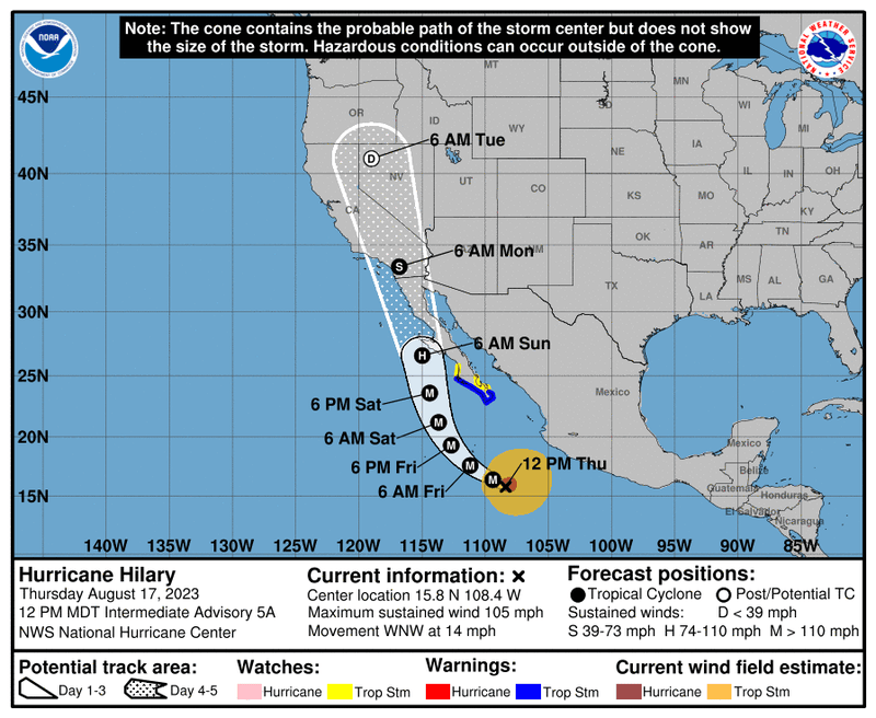
Hillary will become a major hurricane until it approaches the northern Baja - southern California coast this weekend. It will become a tropical storm by then. It's been many years since tropical storm force winds have hit the Southern California coast. Not to mention the copious amounts of rain that will fall this weekend into early next week. The mountainous areas will experience mudslides and some very expensive homes may suffer.
Related

LISTEN on the Audacy App
Tell your Smart Speaker to "PLAY 1080 KRLD"
Sign Up to receive our KRLD Insider Newsletter for more news