
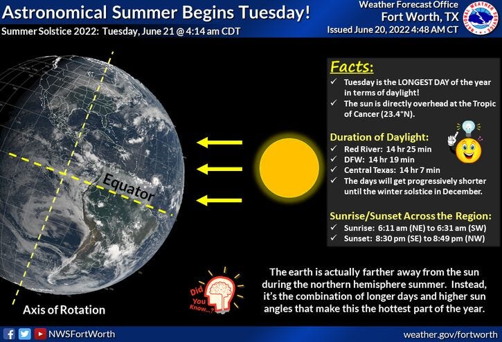
Good morning everyone and happy first day of summer! As you already know, it's been feeling like summer around here for the past couple of months, with above average temperatures and unfortunately, precipitation has been well below average, with the exception of a couple of county rows north towards the Red River. In these areas, you are well above average for this time of the year. Grass is greener in your area, but that won't last very much longer.
A large area of high pressure in the upper levels of the atmosphere will be settling over Texas starting tomorrow, lasting through Saturday, before significant weather change arrives on Sunday.
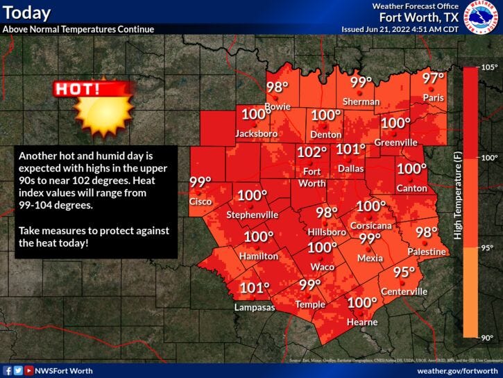
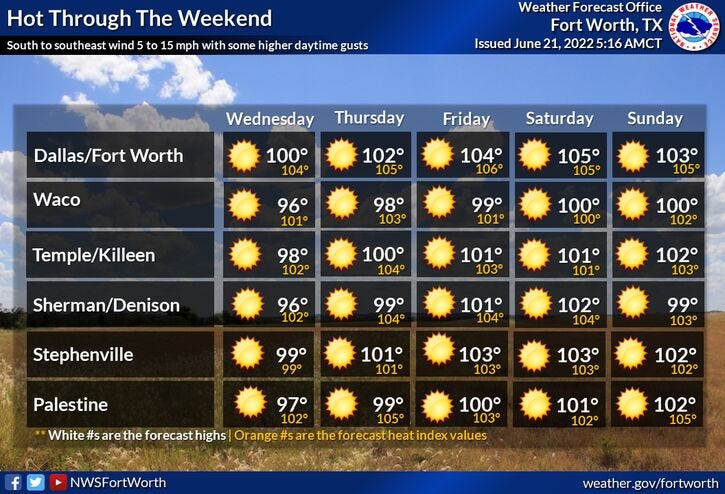
In the meantime, afternoon highs will be at or above 100° today through Saturday, but the hottest two days will be Friday and Saturday. Although this won't be record-breaking heat, we may come close on Thursday. The record is 104°. That's also the starting date of the 1980 heat wave, starting 11 consecutive record-breaking days, with high temperatures at or above100 degrees!
We're starting off this morning anywhere between 76 and 83 degrees! Sunny and hot today with a high of 101. We also have an Air Quality Alert in effect for today. Overnight lows tonight will be between 75 and 81. Plenty of sunshine tomorrow with high around 102. Thursday we hit 103, Friday 104, and on Saturday, we may be as hot as 105 degrees! At least the humidity levels will be low, so we won't be dealing with excessive heat index values.
Our next weather change arrives the first half of Sunday, as a cold front comes through the area. There is a slight chance of showers and storms along the front, but better chances will be south of the Dallas-Fort Worth area by mid-to-late afternoon. Right now, I'm going with a high of 90 degrees. It might be a little hotter, depending on the timing of the cold front. By Monday, the sky will be clear, humidity will be low, and low temperatures will drop into the 60s! Afternoon highs will warm to near 90 degrees. Unfortunately, a rapid warm-up will follow shortly after.
*Yest Rain: 0.00”; *Yest High: 100; Low: 76
*Today’s Averages: High: 93; Low: 73
*Record high: 107 (1936); Record low: 58 (1976)
* June rain: 2.64”; June surplus: +0.10”
*2022 rain: 12.41”; 2022 deficit" 6.72"
*Sunrise: 6:20am; Sunset: 8:40pm
Today: *Air Quality Alert today* Sunny and hot. High: Near 100. Heat index 103. Wind: SSE 10-15 mph.
Tonight: Clear and warm. Low: 75-80. Wind: SE 10-15 mph.
Tomorrow: Sunny and hot. High: Near 100. Heat index 103. Wind: SSE 10-15 mph.
Thursday - Saturday: Sunny and VERY hot. Highs: 102-105.
Sunday: Cloudy early, with a chance of showers and isolated thunderstorms along a COLD FRONT! Decreasing clouds, breezy and MUCH cooler. High: Upper 80s.
Monday: Mostly sunny and warm, not HOT! Dry air dominates! High: Upper 80s.
Related

LISTEN on the Audacy App
Sign Up and Follow NewsRadio 1080 KRLD